
• Skip to main content
  • Skip to secondary menu
  • Skip to primary sidebar
  • Skip to footer
Geographical

Geographical

Official magazine of the Royal Geographical Society (with IBG)

  • Geographical Home
  • News
  • Features
  • Opinion
    • Climatewatch
    • Front Lines
  • Podcast
  • Travel
    • Discovering Britain
    • Passport
  • Culture
    • Book reviews
  • Quizzes
    • Crosswords
  • Choose Geography
    • University directory
    • Masters courses
    • Course guides
      • Climate change
      • Environmental science
      • Human geography
      • Physical geography
    • University pages
      • Aberystwyth University
      • Brunel University
      • Cardiff University
      • University of Chester
      • Edge Hill University
      • The University of Edinburgh
      • Newcastle University
      • Nottingham Trent University
      • Oxford Brookes University
      • The University of Plymouth
      • Queen Mary University of London
    • Geography careers
      • Charity/non-profit
      • Education & research
      • Environment
      • Finance & consulting
      • Government and Local Government
    • Applications and advice
  • Magazine
    • Issue previews
    • Subscribe
    • Manage My Subscription
    • Special Editions
    • Geographical Archive
    • Advertise with us
  • Subscribe
    • Direct Debit Changes

New Met Office supercomputing service can process more than 50 billion weather observations each day

4 November 2026
2 minutes

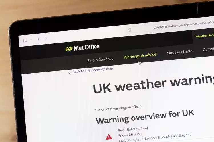
Met Office warning on computer
The supercomputing service will allow the Met Office to process vast amounts of weather and climate data quickly. Image: Shutterstock

The programme is set to deliver £11.3billion in socioeconomic benefits to the UK and will transform the UK’s national weather and climate capabilities


By Victoria Heath

The Met Office has announced that the world’s first fully managed cloud supercomputing service for weather and climate science is now in use, helping the organisation to process huge amounts of weather and climate data at speed.

The new forecasting platform uses around 1.8 million processor cores and performs about 60 quadrillion calculations every second. Each day, the system processes more than 50 billion weather observations, collected to support forecasts, warnings and climate services used across the UK.

The programme is expected to deliver £ 11.3 billion in socioeconomic benefits to the UK, supporting government, businesses and communities, as well as sectors such as aviation, defence and land transport. The new supercomputer service will also benefit severe weather warnings, emergency response, flood forecasting, energy resilience, and climate adaptation.


Enjoying this article? Check out our related reads…

  • How do scientists predict and forecast hurricanes?
  • The troubled waters of NOAA
  • The mapping of Mount Everest
  • Who runs Britain? Inside the outsourcing of the British state
  • Winter blooming of hundreds of plants in UK is a ‘visible sign’ of climate breakdown

Next-generation climate modelling will also be able to run at higher resolutions, helping scientists identify near-term weather and climate hazards.

‘This is a major achievement for the Met Office and the UK. Our new supercomputing capability underpins the forecasts, warnings and climate information that help people, businesses and public services make better decisions,’ said Met Office chief data and information officer Charles Ewen.

‘Its scale allows us to process tens of billions of weather observations every day, conduct increasingly sophisticated scientific modelling and provide reliable services around the clock. This major operational milestone provides a strong foundation for further improvements to weather forecasting, climate science and the services that help the UK stay safe and thrive.’

Heatwave in London. Adults and children play with water to cool at a dancing fountain at Grany Square, summer of 2019 is hottest ever measured with record high temperature. London, UK - August 1, 2019
The supercomputing service will help ensure accurate severe weather warnings, like those issued during the heatwave earlier this year. Image: Nicolas Economou/Shutterstock

The Met Office generates forecasts by running computerised numerical weather models that analyse billions of observations. This helps meteorologists predict how current conditions could develop in the future. The organisation relies on ensemble modelling, a forecasting method in which many simulations run from slightly different starting conditions to keep forecasts accurate.

According to the Met Office, its four-day forecast is now as accurate as a one-day forecast was 30 years ago.
Themes News Climate

Protected by Copyscape

Primary Sidebar

SUBSCRIBE

GEOGRAPHICAL WEEKLY LOGO FREE - Sign up to get context, clarity and perspective in a noisy world, every Friday

Popular Now

Glacier in Antarctica Wilhelmina Bay Beautiful Frozen Landscape. Wide Snow on Mountain Range. View from Cruise Ship Climate Change Melting Ice Caps

Antarctic sea ice loss is impacting a major ‘freshwater engine’

Greenpeace UK successfully place giant boulders onto the seabed in the Southern North Sea - the UK’s most bottom-trawled Marine Protected Area - forming an underwater barrier to prevent this destructive fishing method. Located off England's east coast, the targeted stretch sits within a so-called Marine Protected Area (MPA), which was created specifically to protect harbour porpoises.

‘Boulder barrier’ deployed by activists to protect porpoises in UK waters

Sheep grazing on the coast of southern Greenland

The battle to save Greenland’s sheep farms from a multibillion-dollar mine

Quebec City skyline in autumn with Saint Lawrence River and boats on the foreground, Canada

The Canadian province with an empire state of mind

QUIZ: Capital Cities – Hard

QUIZ: Capital Cities – Hard

Footer

  • Facebook
  • Instagram
  • LinkedIn
  • Reddit
  • TikTok
  • Twitter
  • YouTube

Geographical print magazine cover

Published in the UK since 1935, Geographical is the official magazine of the Royal Geographical Society (with IBG).

Informative, authoritative and educational, this site’s content covers a wide range of subject areas, including geography, culture, wildlife and exploration, illustrated with superb photography.

Click Here for SUBSCRIPTION details

Want to access Geographical on your tablet or smartphone? Press the Apple, Android or PC/Mac image below to download the app for your device

Footer Apple Footer Android Footer Mac-PC

More from Geographical

  • Subscriptions
  • Get our Newsletter
  • About Us
  • Contact Us
  • Advertise with us
  • Privacy policy
  • Terms & Conditions

Copyright © 2026 · Site by Syon Media