NOAA firings and funding cuts threaten global weather forecasting, and will likely hit vulnerable nations hardest
By
Recent firings and funding cuts at the National Oceanic and Atmospheric Administration (NOAA), the USA’s leading weather and climate research agency, are causing concern across the globe. While the immediate impacts are being noticed within the USA, experts warn that the long-term consequences will disproportionately affect vulnerable communities in poorer nations, particularly those in regions such as the Caribbean, which lack the resources to independently monitor increasingly volatile weather patterns.
Enjoying the article? Check out our related reads:
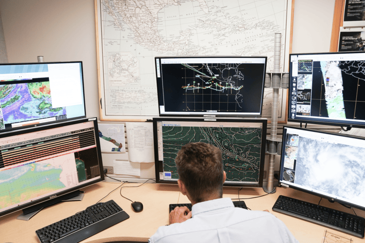
A leaked internal memo, obtained by Politico’s E&E News, has revealed NOAA’s recent decision to adopt a ‘minimum mission operations approach’ for its crucial polar weather satellites. These satellites form the backbone of three- and seven-day forecasts, and act as an early warning system for extreme events such as hurricanes and tornadoes. Former NOAA officials have stated that this reduced operational capacity puts the accuracy of these vital predictions at significant risk.
This development comes on the heels of widespread staff reductions within NOAA and other government agencies; US Senator Maria Cantwell has stated that more than 880 NOAA employees have been fired under the current administration so far. This figure includes personnel from the National Weather Service, researchers dedicated to improving hurricane forecasts and developing next-generation weather models, and even the ‘Hurricane Hunters’ – the teams who fly directly into storms to gather critical data.
Adding to the upheaval, more than 500 additional staff members reportedly accepted early resignation offers, further depleting the agency’s already stretched resources. While a recent court order temporarily reinstated some probationary workers, reports indicate they remain on administrative leave, leaving the ongoing impact on operations unclear.
Another 1,000 jobs are said to still be at risk, potentially bringing the total workforce reduction to 20 per cent, while dozens of NOAA offices have been listed for potential lease terminations. One of these is the Mauna Loa Observatory in Hilo, Hawaii, the source of the Keeling Curve, a continuous, long-term record of atmospheric carbon dioxide concentrations.
Every year, NOAA’s National Weather Service delivers more than 1.5 million forecasts and 50,000 crucial weather warnings. This vital lead time for hurricanes, tornadoes, wildfires and severe storms prevents billions in economic losses and saves thousands of lives each year. The American Meteorological Society has issued a stark warning, stating that these firings will ‘cause irreparable harm and have far-reaching consequences for public safety, economic well-being, and the United States’s global leadership’.
However, the consequences extend far beyond US borders. NOAA plays a pivotal role in the global weather monitoring and forecasting ecosystem. As Daniel Swain, a climate scientist at UCLA, pointed out on X: ‘Most or all private weather companies in [the] US (including forecasts that you see on TV or your favourite app) are built directly atop [a] backbone of taxpayer-funded instrumentation, data, predictive modelling, and forecasts provided by NOAA.’ This foundational data, collected from a network of ocean buoys, satellites and radar systems, is fed into global weather models that underpin forecasts worldwide. Some of these services have already been halted, including weather balloon launches in Albany (New York), Gray (Maine) and Kotzebue (Alaska).
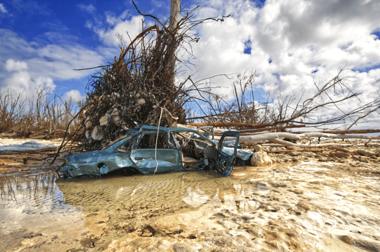
For wealthier nations, a dip in the accuracy or reliability of NOAA’s data might be mitigated by their own meteorological agencies and research capabilities. However, for poorer countries, particularly small island developing states in the Caribbean, the situation is far more precarious. These nations are often on the front lines of climate change, facing increasing threats from more intense hurricanes, rising sea levels and changing weather patterns. They rely heavily on international data and forecasting provided by agencies such as NOAA, as they often lack the financial and technical capacity to establish and maintain their own comprehensive weather monitoring and analysis systems.
Beyond immediate disaster preparedness, NOAA’s data also underpin long-term climate change monitoring and adaptation planning. For resource-limited nations, understanding nuanced future impacts is vital for sustainable development; reduced data quality or availability could impede informed decisions and access to international aid.
Accurate and timely warnings are crucial for island nations to prepare for extreme weather events, allowing for evacuations, resource mobilisation and, ultimately, saved lives and livelihoods. Delays in NOAA’s satellite data processing or a reduction in the accuracy of long-range forecasts could mean less lead time for warnings, leaving these communities more vulnerable than ever.