
• Skip to main content
  • Skip to secondary menu
  • Skip to primary sidebar
  • Skip to footer
Geographical

Geographical

Official magazine of the Royal Geographical Society (with IBG)

  • Geographical Home
  • News
  • Features
  • Opinion
    • Climatewatch
    • Front Lines
  • Podcast
  • Travel
    • Discovering Britain
    • Passport
  • Culture
    • Book reviews
  • Quizzes
    • Crosswords
  • Choose Geography
    • University directory
    • Masters courses
    • Course guides
      • Climate change
      • Environmental science
      • Human geography
      • Physical geography
    • University pages
      • Aberystwyth University
      • Brunel University
      • Cardiff University
      • University of Chester
      • Edge Hill University
      • The University of Edinburgh
      • Newcastle University
      • Nottingham Trent University
      • Oxford Brookes University
      • The University of Plymouth
      • Queen Mary University of London
    • Geography careers
      • Charity/non-profit
      • Education & research
      • Environment
      • Finance & consulting
      • Government and Local Government
    • Applications and advice
  • Magazine
    • Issue previews
    • Subscribe
    • Manage My Subscription
    • Special Editions
    • Geographical Archive
    • Advertise with us
  • Subscribe
    • Direct Debit Changes

Antarctic sea ice loss is impacting a major ‘freshwater engine’

31 October 2026
3 minutes

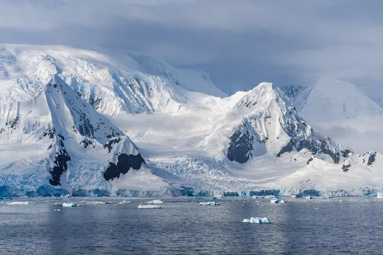
Glacier in Antarctica Wilhelmina Bay Beautiful Frozen Landscape. Wide Snow on Mountain Range. View from Cruise Ship Climate Change Melting Ice Caps
A layer of water known as Antarctic Intermediate Water has changed due to melting Antarctic ice. Image: Shutterstock

Declining ice has led to saltier and denser water that could influence atmospheric circulation and weather in the Southern Hemisphere – and even globally


By Victoria Heath

Melting ice in Antarctica is changing seawater and could drive major shifts in the world’s oceans, a new study published in Nature has revealed.

Normally, ice forms in Antarctica between May and July and then melts when temperatures rise, releasing freshwater into the ocean. However, researchers found that this layer of water, known as Antarctic Intermediate Water (AAIW), became saltier and denser between 2016 and 2024, coinciding with record-low Antarctic sea ice. This weaker layer could mean heat can travel farther into the ocean, suggesting scientists may have underestimated the extent of deep-ocean warming and rising sea levels.


Enjoying this article? Check out our related reads…
  • Geo Explainer: The Gaza Strip
  • Sky rapids behind extreme flooding in the Middle East
  • Global warming projected to divert ‘atmospheric rivers’ to Asia’s cities
  • A verdant Siberia?
  • A huge hole almost the size of Portugal found in Antarctic sea ice

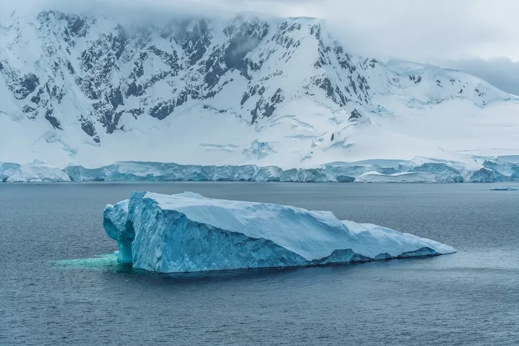
Huge Floating Iceberg in Antarctica. Beautiful Natural Destination Near South Pole. Adventure Travel View From Ship Melting Icecaps Climate Change
The Antarctic region is the freshwater engine of oceans worldwide. Image: Shutterstock

The Antarctic Intermediate Water spans much of the Southern Hemisphere’s four oceans and helps store carbon, supply oxygen, and drive global ocean currents. Researchers stress that melting Antarctic sea ice influences ocean circulation thousands of kilometres away.

‘It was quite surprising. This alteration is happening very quickly,’ said study lead and University of Melbourne associate professor Bishakhdatta Gayen. ‘Since we have records in oceanography, we have never seen this water alter.’

‘If the altered AAIW changes the way surface water is carried down into deeper layers, it could affect how much carbon the ocean locks away – although the magnitude and timing are uncertain,’ Gayen continued.

The team analysed data from a network of around 4,000 robotic floats that sample the upper ocean, along with satellite and atmospheric datasets. The Antarctic Intermediate Water last changed around 130,000 years ago, when little ice covered Antarctica.

‘That transition took thousands of years, not two decades,’ said Gayen.

Antarctica contains 90 per cent of the planet’s freshwater ice, with more than 99.5 per cent of the continent covered in ice.

The Antarctic Ice Sheet measures nearly 4.9 kilometres (3 miles) at its thickest point and contains about 30 million cubic kilometres (7.2 million cubic miles) of ice. If the entire ice sheet melted, sea levels would rise about 58 metres (190 feet).

Between 2002 and 2025, Antarctica lost about 135 gigatons of ice per year, raising global sea levels by 0.4 millimetres annually.

Over the last 50 years, the west coast of the Antarctic Peninsula has become one of the planet’s fastest-warming regions, affecting everything from the distribution of penguin colonies to the abundance of Antarctic krill, which are vital to marine food chains. Glaciers and ice shelves in Antarctica have also retreated in recent years due to global warming, with some collapsing completely.
Themes News

Protected by Copyscape

Primary Sidebar

SUBSCRIBE

GEOGRAPHICAL WEEKLY LOGO FREE - Sign up to get context, clarity and perspective in a noisy world, every Friday

Popular Now

On The Ground: The Aberfan Tribunal

On The Ground: The Aberfan Tribunal

Shompen band traversing a river on Great Nicobar Island.

UN urges India to suspend controversial mega-project on Great Nicobar Island

3d globe inside digital scanning frame.

AI or climate change – which poses the greater threat to humanity?

A priest beside health workers in protective equipment outside a metal-walled building in Mongbwalu

Why war is making the DRC’s Ebola outbreak harder to stop

Copernicus Marine Service visualisations show the impact of Super Typhoon Champi on the Philippine Sea on 21 October 2026. With winds reaching 296 km/h, the Category 5 storm was the strongest tropical cyclone recorded in 2026. The images show the anticlockwise movement of wind-generated waves (left) and significant wave heights reaching 10 metres near the storm’s centre (right).

Typhoon Champi hits Taiwan

Footer

  • Facebook
  • Instagram
  • LinkedIn
  • Reddit
  • TikTok
  • Twitter
  • YouTube

Geographical print magazine cover

Published in the UK since 1935, Geographical is the official magazine of the Royal Geographical Society (with IBG).

Informative, authoritative and educational, this site’s content covers a wide range of subject areas, including geography, culture, wildlife and exploration, illustrated with superb photography.

Click Here for SUBSCRIPTION details

Want to access Geographical on your tablet or smartphone? Press the Apple, Android or PC/Mac image below to download the app for your device

Footer Apple Footer Android Footer Mac-PC

More from Geographical

  • Subscriptions
  • Get our Newsletter
  • About Us
  • Contact Us
  • Advertise with us
  • Privacy policy
  • Terms & Conditions

Copyright © 2026 · Site by Syon Media