• Skip to main content
  • Skip to secondary menu
  • Skip to primary sidebar
  • Skip to footer
Geographical

Geographical

Official magazine of the Royal Geographical Society (with IBG)

  • Home
  • Briefing
  • Science & Environment
  • Climate
    • Climatewatch
  • Wildlife
  • Culture
  • Geopolitics
    • Geopolitical hotspots
  • Study Geography
    • University directory
    • Masters courses
    • Course guides
      • Climate change
      • Environmental science
      • Human geography
      • Physical geography
    • University pages
      • Aberystwyth University
      • Brunel University
      • Cardiff University
      • University of Chester
      • Edge Hill University
      • The University of Edinburgh
      • Newcastle University
      • Nottingham Trent University
      • Oxford Brookes University
      • The University of Plymouth
      • Queen Mary University of London
    • Geography careers
      • Charity/non-profit
      • Education & research
      • Environment
      • Finance & consulting
      • Government and Local Government
    • Applications and advice
  • Quizzes
  • Magazine
    • Issue previews
    • Subscribe
    • Manage My Subscription
    • Special Editions
    • Podcasts
    • Geographical Archive
    • Book reviews
    • Crosswords
    • Advertise with us
  • Subscribe
    • Direct Debit Changes

Huge hidden flood bursts through Greenland ice sheet surface

31 July 2025
3 minutes

The terminus of Hisinger Glacier, Dickson Fiord, Northeast Greenland National Park. Image: Jane Rix/Shutterstock

First ever recorded instance of flood highlights destructive potential of meltwater stored beneath Greenland ice sheet


By Victoria Heath

For the first time, a huge flood, triggered by the rapid draining of a lake beneath the Greenland ice sheet, occurred with such force that it fractured ice and burst out across its surface.

The phenomenon, detailed in research published in Nature Geoscience, sheds new light on the destructive potential of meltwater stored beneath the ice sheet. Under extreme conditions, the research found, water flooding underneath the ice can force its way through the ice and escape at the ice sheet surface.


Enjoying this article? Check out our related reads:

  • Shining a light on Earth’s shrinking ice sheets
  • Coastal communities are under threat from Greenland melting
  • Greenland Ice Sheet cracking more amid climate change, new study reveals
  • Science at the Summit – the research centre high on Greenland’s ice sheet
  • Melting Antarctic ice sheets slowing Earth’s strongest ocean current, study finds

Numerical models do not include the event in their predictions of the future evolution of the Greenland ice sheet. As such, this new work raises questions about whether this type of mechanism deserves greater attention in the future.

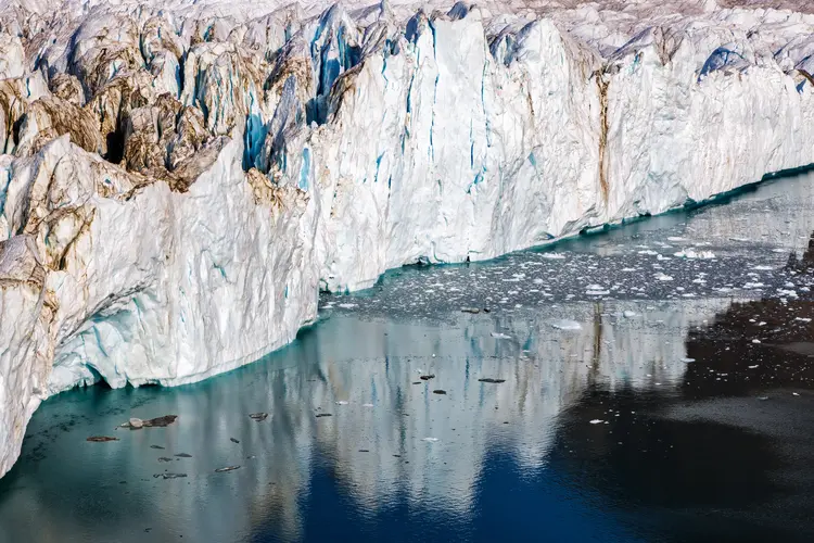
The international team of researchers led by scientists at Lancaster University’s Centre of Excellence in Environmental Data Science and the UK Centre for Polar Observation and Modelling studied a previously undetected lake beneath the ice sheet (known as a subglacial lake) in a remote region of northern Greenland, using state-of-the-art satellite data and numerical models.

Using 3D representations of the ice sheet, they were able to monitor the sudden drainage of the lake, finding that across a period of ten days in summer 2014, an 85-metre-deep crater appeared across a 2 km2 area in the ice surface, as 90 million cubic metres of water flooded out of the underlying lake.

This roughly equates to nine hours of water gushing over the Niagara Falls during its peak season, representing one of the largest Greenland subglacial floods in recorded history.

Front view of the terminus of Hisinger Glacier, Dickson Fiord, Northeast Greenland National Park. This is part of the Greenland Ice Sheet, and shows the glacial ice with reflection.
Previously, researchers assumed meltwater flows from the surface to the base of the ice sheet. In reality, this research proves water can also travel upwards. Image: Shutterstock

Further downstream, researchers also found the sudden appearance of an area equivalent in size to around 54 football pitches of fractured and distorted ice, with deep cracks and uprooted ice blocks.

‘When we first saw this, because it was so unexpected, we thought there was an issue with our data,’ said lead author Dr Jade Bowling. ‘However, as we went deeper into our analysis, it became clear that what we were observing was the aftermath of a huge flood of water escaping from underneath the ice.’

‘The existence of subglacial lakes beneath the Greenland Ice Sheet is still a relatively recent discovery, and – as our study shows – there is still much we don’t know about how they evolve and how they can impact the ice sheet system.’

‘Importantly, our work demonstrates the need to better understand how often they drain, and, critically, what the consequences are for the surrounding ice sheet,’ Bowling continued.

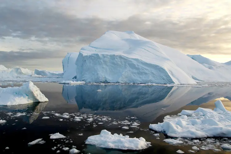
The discoveries reported by researchers highlight the complexity of water flow and the need to better understand how the ice sheet responds to extreme inputs of meltwater – something likely to become more common as our climate warms and consequently, surface melting intensifies.

Is Greenland melting?

The short answer: yes. An estimated 28,707 kilometres of Greenland’s ice sheet and glaciers have melted across the last three decades, according to recent analysis of satellite records.

The total area of ice loss is equivalent to the size of Albania, representing around 1.6 per cent of Greenland’s total ice and glacier cover. Former areas of ice and snow have been replaced by rock, wetlands and shrub areas.

According to scientists, one reason to explain such drastic differences in ice cover is warmer air temperature, which also has an impact on the temperature of land surfaces, greenhouse gas emissions and the landscape’s stability.

Permafrost – a permanently frozen layer beneath the Earth’s surface – is also becoming degraded. In some areas, this may have a significant impact on buildings and communities that reside above it.

Themes Science & Environment greenland

Protected by Copyscape

Primary Sidebar

OUR UK DIRECT DEBITS ARE CHANGING
WINTER SALE

Geographical subscriptions

GEOGRAPHICAL WEEKLY LOGOFREE - Sign up to get global stories, told well, straight to your inbox every Friday

Popular Now

Kharg Island

Kharg Island: the small but vitally important piece of land powering Iran’s…

Pangolin

Wildlife Justice Commission reflects on a decade of impact with multimedia report

Normany dairy cattle. Ruminants are the most methane-intense livestock

Five unusual climate solutions you probably haven’t heard of

Satellite in space

Space is cooling down – here’s why it matters to the planet

Passu Cones, also known as Passu Cathedral, 6,106m high are a series of towering peaks located in the Karakoram Range alongside the karakoram highway

Into the unknown

Footer

  • Facebook
  • Instagram
  • LinkedIn
  • Reddit
  • TikTok
  • Twitter
  • YouTube

Geographical print magazine cover

Published in the UK since 1935, Geographical is the official magazine of the Royal Geographical Society (with IBG).

Informative, authoritative and educational, this site’s content covers a wide range of subject areas, including geography, culture, wildlife and exploration, illustrated with superb photography.

Click Here for SUBSCRIPTION details

Want to access Geographical on your tablet or smartphone? Press the Apple, Android or PC/Mac image below to download the app for your device

Footer Apple Footer Android Footer Mac-PC

More from Geographical

  • Subscriptions
  • Get our Newsletter
  • About Us
  • Contact Us
  • Advertise with us
  • Privacy policy
  • Terms & Conditions

Copyright © 2026 · Site by Syon Media