

From Tokyo to New Orleans, discover the cities that are impacted by natural disasters the most and why they are so vulnerable
By
Around the world, approximately 417 natural disasters are recorded each year. From typhoons to storm surges, landslides to earthquakes, the events can cause catastrophic damage and impact to the local communities they occur in.
But some areas in the world are particularly hotspots for natural disasters. Here are ten of the most disaster-prone cities, and the reasons why their geography and location make them so susceptible to these events…
Tokyo, Japan

Widely considered one of the world’s most disaster-prone cities, Tokyo faces a wide range of natural hazards while also being one of the largest metropolitan areas on Earth. It faces threats from earthquakes, tsunamis, typhoons, floods and extreme heat.
Japan lies on the Pacific Ring of Fire, an extremely seismically active region, meaning earthquakes are far more common than in other countries. Near Tokyo, four tectonic plates converge – the Pacific Plate, the Philippine Sea Plate, the Eurasian Plate and the North American Plate. As such, Tokyo remains highly vulnerable to powerful earthquakes, and is almost always ‘shaking’ – although most quakes go unnoticed.
Enjoying this article? Check out our related reads…
Tokyo also remains highly susceptible to flooding, particularly in its low-lying eastern districts alongside rivers and seas. According to ThinkHazard, potentially damaging and life-threatening river floods are expected to occur at least once in the next 10 years in the city. Climate change is only exacerbating this, with increased temperatures triggering increased rainfall and rising sea levels.
Manila, Philippines
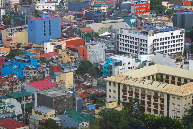
Like Tokyo, Manila is located on the Pacific Ring of Fire – along two tectonic plates – exposing it to numerous disasters such as typhoons, storm surges, earthquakes, and flooding.
Every year, the Philippines experiences around 20 typhoons, mainly affecting the Luzon and Manila regions. These typhoons can cause torrential rainfall, destructive winds, and flooding, as well as widespread displacement for individuals trying to move out of their paths.
One of the most deadly typhoons to hit Manila was Typhoon Ketsana (Ondoy) in 2009, bringing a month’s worth of rainfall in just several hours. At least 140 died from the storm, and more than 450,000 people were displaced.
Los Angeles, United States

Across the last 20 years, Los Angeles, California, has experienced 74 disasters – most of which are fire-related.
Back in early 2025, the city was left reeling after a series of wildfires rampaged through neighbourhoods. More than 16,000 structures were destroyed in the blazes, and 31 individuals were killed.
The region is particularly prone to such disasters due to its climate – with wet autumns and winters followed by dry summers – and the Santa Ana winds, strong gusts that contribute to two fire seasons.
California is also located along the Pacific Ring of FIre, and has around 15,700 earthquake faults running through it. This includes more than 500 faults categorised as ‘active’, such as the San Andreas and Hayward faults.
Tehran, Iran

Iran is prone to many natural disasters, including droughts, earthquakes, storms and landslides. Over the past century, it has experienced more than 250 such disasters. In total, they have impacted more than 60 million people, killed at least 158,350, and caused an estimated damage of more than US$53 billion.
Densely populated urban areas like Tehran are particularly at risk of suffering devastating consequences from natural disasters. Located near strong seismic activity and with several fault lines through the city, Tehran remains highly vulnerable. In particular, many buildings were created in Tehran without consideration of where these fault lines run.
The city also possesses unique characteristics that make it prone to flash floods, having mountains in the north and desert in the south. This causes water to flow through Tehran along a north-to-south axis, making rivers more likely to overflow.
Jakarta, Indonesia
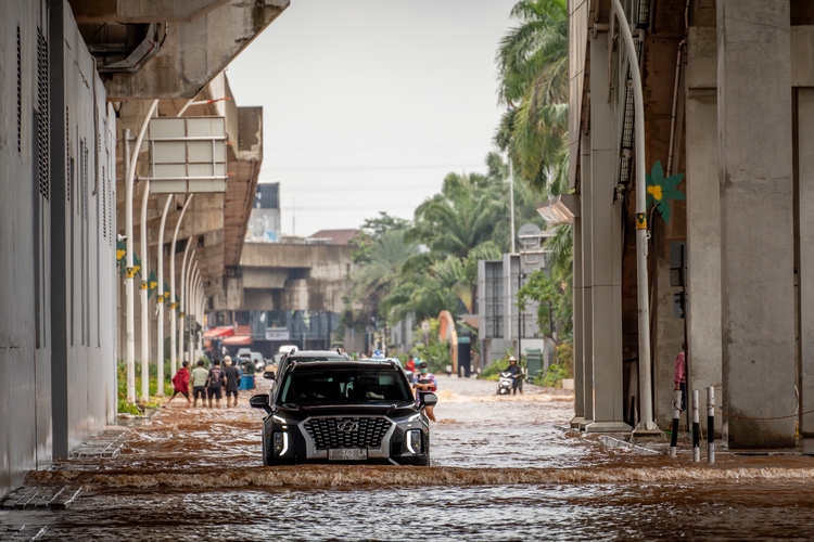
According to government estimates, 97 per cent of the Indonesian population live in areas prone to disasters. The whole nation is located on the Pacific Ring of Fire, and at the intersection of three active tectonic plates.
However, in addition to earthquakes, Indonesia – and its capital, Jakarta – is exposed to volcanic eruptions, cyclones, floods, landslides and tsunamis. In particular, floods impact the region, especially vulnerable communities along the banks of the Ciliwung River, the main river that runs through Jakarta. In 2007, the city experienced its worst-ever flood, submerging around 70 per cent of Jakarta with water levels as high as four metres.
Most of Jakarta is flat, coastal lowland with an elevation of less than ten metres above sea level, making rising levels as a result of climate change a pertinent threat to the nation.
Kolkata, India
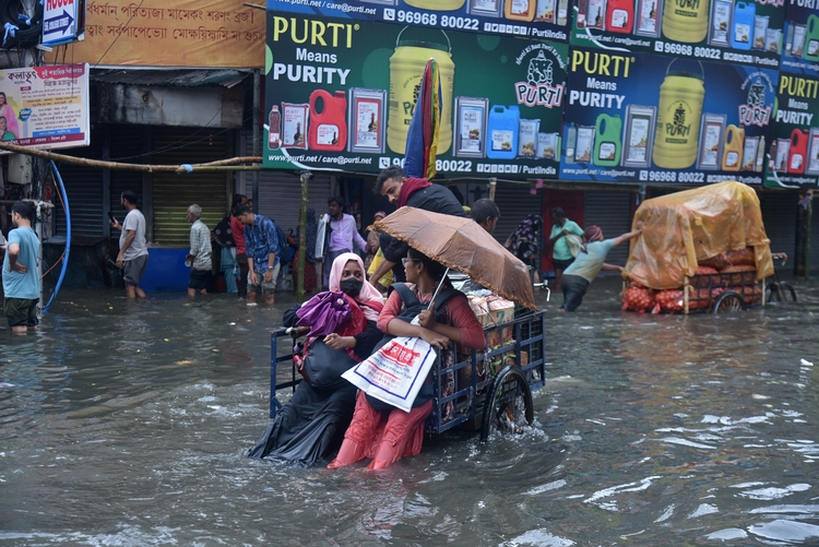
According to scientists, climate change has made extreme weather events – such as flooding – more common in the city of Kolkata. Last September, the city received more than 12 per cent of its average annual rainfall in just 24 hours, with the subsequent flooding claiming lives and causing extensive property damage.
Additionally, the city’s ageing drainage system exacerbated the impact of the flood.
But it’s not just flooding that Kolkata experiences. The city was also devastated by a powerful cyclone back in 2020, which killed at least 84 people. Thousands of trees were uprooted in high winds, and electricity cables were brought to a standstill, leaving 14 million people without power.
Miami, United States
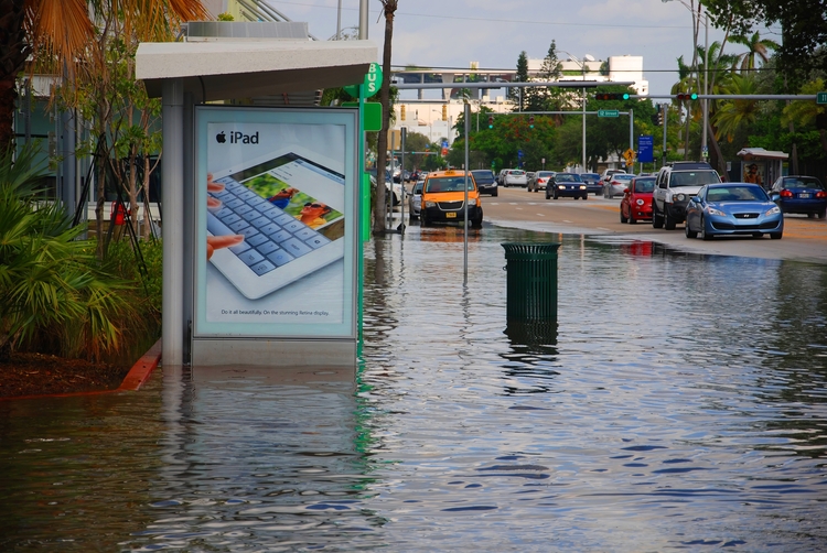
Due to climate change, Miami is considered by some to be the most vulnerable coastal city in the US to natural disasters. It experiences increased risks from heat, floods, hurricanes and heavy rainfall.
In recent years, Miami’s famous beachfront has been subject to severe hurricane damage and continual flooding at high tides as a result of rising sea levels. As well as these impacts, such events have also compromised drinking water as saltwater has intruded into waste treatment plants.
High summer temperatures in the city are so extreme that Miami has become the first place in the world to elect a chief heat officer, appointed to develop strategies to protect vulnerable populations.
As global temperatures continue to rise, hurricane intensity and rainfall are only projected to increase in Miami. This means Miamians would be more likely to see Category 4 and 5 storms in the city.
New Orleans, United States

New Orleans is heavily impacted by the impacts of climate change, making it more prone to risks from heat, rainfall and floods.
One key factor contributing to these risks is the city’s extremely low elevation levels, with New Orleans resting around six feet below sea level on average.
New Orleans has been subjected to a lengthy history of destructive hurricanes, particularly Hurricane Katrina, the costliest hurricane in US history. Katrina contributed to the destruction of more than 800,000 housing units as it tore through communities.
To help combat future natural disasters, the city is rebuilding and replacing old structures so that buildings can be elevated above flood levels.
Vancouver, Canada
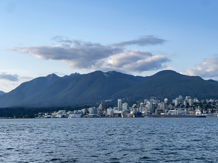
Every year, thousands of earthquakes occur in British Columbia – the province that Vancouver is located in. However, most are so small and go unnoticed.
Yet seismologists say Vancouver is still at a daily risk of a damaging, life-changing earthquake.
Other major disasters impacting Vancouver include wildfires, with wildfire smoke a major cause of poor air quality and air pollution in the city. Inhaling these small particles, known as PM2.5, can cause mild to severe health effects.


