Nearly 50 years after one of the great rainforest expeditions, the scientists and explorers who helped reveal the secrets of Borneo’s Gunung Mulu return to a landscape transformed
By Izzy Sasada
It’s 6am and the air is already humid as the group follows a narrow footpath up the hill. With head torches, they illuminate the path ahead, carefully placing their feet to avoid the branches and roots hidden on the jungle floor underfoot. After a 15-minute climb, they reach the summit. The group of around 20 waits in anticipation for the sun to peek above the clouds in the distance, illuminating Gunung Api and the vast Bornean jungle canopy it overlooks. A hornbill flies over the trees. The rainforest begins to wake up.
Enjoying this article? Check out our related reads…
It’s a motley crew, made up of ageing explorers, scientists who shaped our understanding of the world’s rainforests, doctors, nurses, anthropologists and a film-maker who spent much of his career working with David Attenborough. And they are no ordinary visitors to Borneo’s Gunung Mulu National Park, now a UNESCO World Heritage site. Nearly half a century ago, they were some of the first foreign visitors to this extraordinary Eden, participating in one of the most ambitious scientific expeditions of its time. By the end of the expedition, Mulu had become one of the most intensively studied rainforests on Earth.
In March 2026, a handful of the original explorers – and some of their children – were welcomed back by Hein Gerstner, the manager of Mulu Park, this time as tourists, to meet old friends and to see how the place has changed.
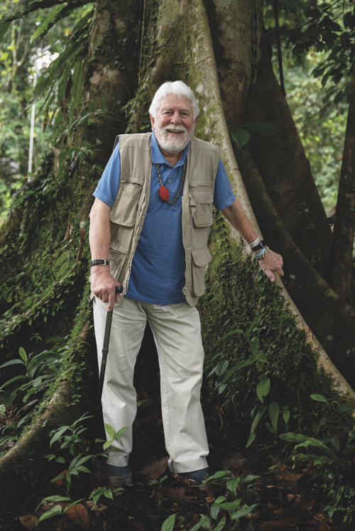
Between 1977 and 1978, more than 115 scientists from Malaysia and around the world descended on Mulu National Park as part of a joint multidisciplinary survey of this extraordinary region. The project was co-led by Robin Hanbury-Tenison for the Royal Geographical Society and Dr Paul Chai for the Sarawak Forestry Department of the Sarawak government.
They mapped some of the world’s largest cave chambers and documented thousands of species previously unknown to Western science. These outcomes shaped our modern understanding of rainforest ecosystems and provided a management plan for the future of Mulu’s forests and caves.
One of the key findings came from the ecology team, led by scientist John Proctor. They ‘cracked the code’ of the rainforest by placing nets on the ground and observing how rapidly the leaves were broken down by centipedes and millipedes.
‘We found that the nutrients are constantly being recycled through trees and virtually no nutrients are kept in the soil at all,’ says Robin Hanbury-Tenison, who led the expedition and founded the NGO Survival International.
‘This explains why when trees are cut down, nothing is left but a thin layer of poor soil,’ Hanbury-Tenison explains.
This key finding helped to launch the global rainforest movement, which campaigned – mostly unsuccessfully – to protect the world’s remaining tropical rainforests from the threat of deforestation.
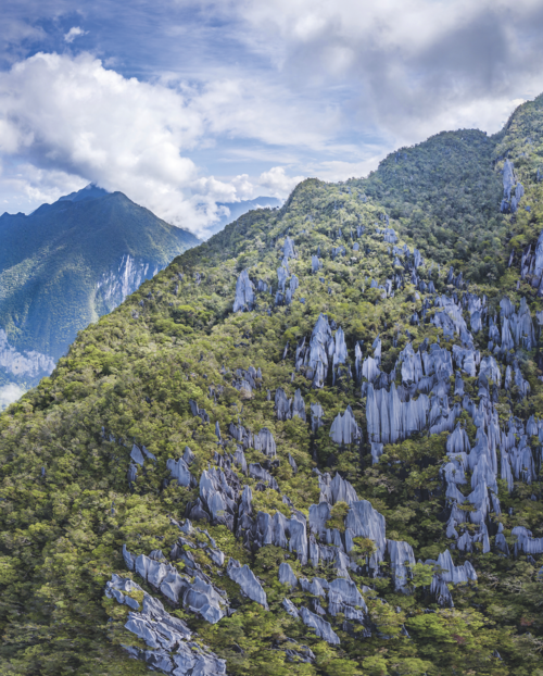
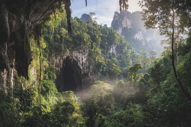
The dense forest cover is punctuated by distinctive limestone outcrops. Image: Lukas Vejri/Shutterstock
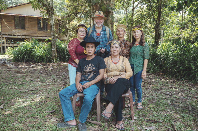
The fieldwork and its findings were only possible due to the skills and expertise of the local Indigenous Berawan and Penan communities, who worked alongside the scientists. Today, many of those community members and their descendants still live within and around the park. And many of them remember the expedition well.
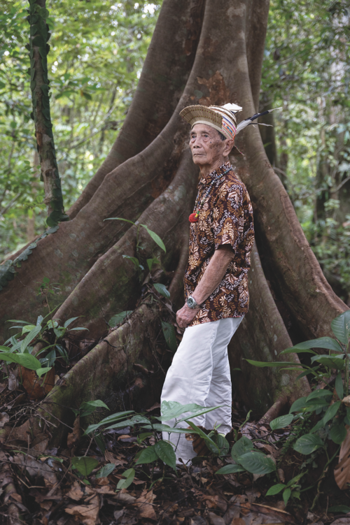
‘Our grandparents and elders told us stories about the RGS expedition, and had fond memories of that time,’ says Dayang Ukau, a member of the Indigenous Penan community who lives in Bateu Bungan, a settlement near the park headquarters. ‘They remembered working together and the friendships that came from it, which lasted long after the expedition ended.’
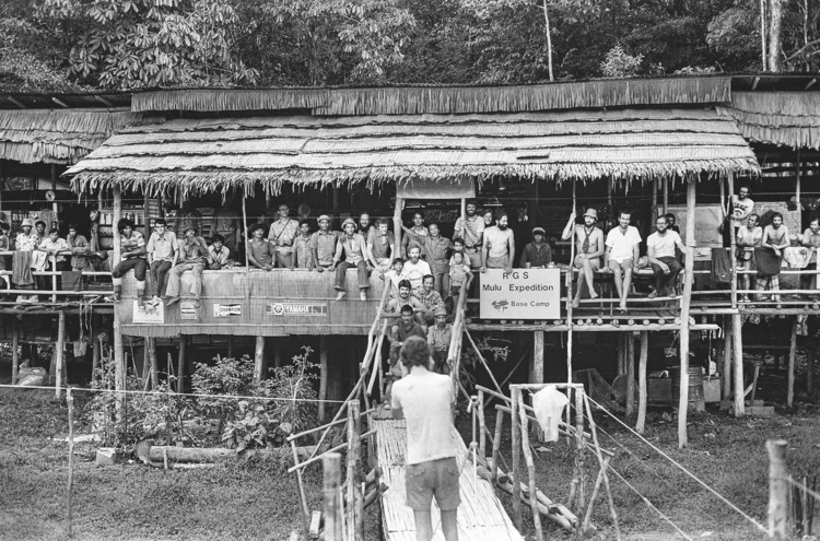
Nearly 50 years later, the returnees were welcomed by both communities. Afternoons were spent poring over black-and-white images from the 1970s, of young men who are now elders, and of children who are now adults. Stories from half a century ago were shared, and for many, the reunion was incredibly emotional.
‘To have the team from that expedition return to Mulu means a lot,’ says Dayang. ‘You won’t see this kind of welcome so often!’
While the 150 members of the Berawan community who joined the expedition formed a vital part of it, working as guides and porters, the Penan community’s intimate knowledge of the rainforest was key to its many scientific discoveries. They were traditionally nomadic hunter-gatherers across Sarawak, including the area that is now Mulu National Park.
‘For the Penan, this forest is alive, pulsing, responsive in a thousand ways to their physical needs and their spiritual readiness,’ anthropologist and ethnobotanist Wade Davis writes in his book Penan: Voice for the Borneo Rainforest. ‘For the Penan, all of these plants are sacred, possessed by souls and born of the same earth that gave birth to the people.’
‘For the Penan, this forest is alive, pulsing, responsive in a thousand ways to their physical needs and their spiritual readiness’
Today, there’s a recognition that the expedition’s legacy and success are inseparable from the Indigenous knowledge on which the scientists depended.
‘I interviewed all the scientists and asked them what they did when I wrote a book about the expedition,’ says Hanbury-Tenison. ‘Every scientist said the same thing: “We are not experts. The Penan are.”’
Both the landscape around Mulu and the lives of its inhabitants have changed dramatically in the last half-century. The expedition predated the rapid deforestation that took place across Borneo in the years since. Some estimates suggest that, in the past five decades, around 90 per cent of Sarawak’s primary rainforest has been cleared, mainly for export.
At the time, many Penan families were still living nomadically. In the years since, most have settled, due to a combination of factors. And yet, the majority of Mulu’s mighty rainforest still stands. Epic limestone pinnacles stretch up from the canopy and vast cave systems extend for hundreds of kilometres underground. Each evening, an estimated three million bats leave Deer Cave. The exodus is one of the attractions that draws around 20,000 visitors a year to Mulu from across the world.
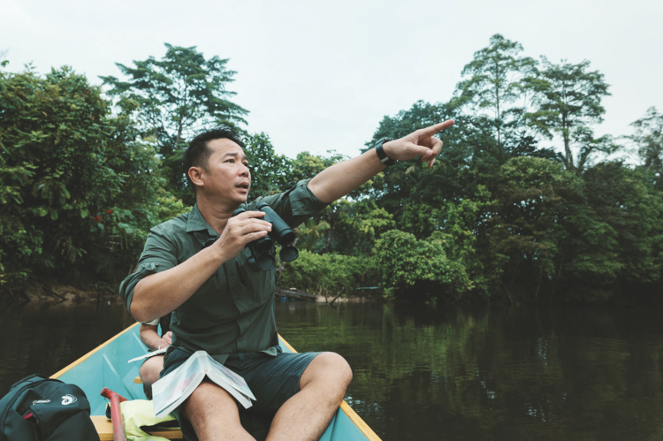
The question now isn’t what remains to be discovered in Mulu, but who will lead that discovery under the stewardship of the Sarawak Forestry Corporation and the park’s extensive ranger team. The next chapter of stewardship, research and exploration in Mulu may look very different from the previous one – one in which Indigenous communities are not only guides or co-facilitators of exploratory research, but the authors themselves.
From the hilltop, the group looks out across the expansive rainforest canopy. At the base of the hill lies the site of their former base camp – a temporary wooden longhouse called Long Pala – which was home for the 15-month expedition. Today, it’s no longer there.
After some reminiscing, the crew make their way back to today’s base camp: the national park headquarters. There, Nigel Winser, who coordinated the original expedition, and Hein Gerstner, the park manager, are awaiting their return. Nearly 50 years ago, Winser’s job was to keep base camp running while others pushed deeper into the forest. Today, he’s doing much the same. Though much has changed for Mulu, its people and for exploration, some things stay the same.