The destructive force of the Great Chilean Earthquake led to deadly consequences in both Chile and countries across the Pacific Ocean
By Victoria Heath
With a magnitude of 9.5, the Great Chilean Earthquake struck southern Chile on May 22, 1960, the most powerful earthquake recorded to date. The previous day, foreshocks occurred in Chile, including a magnitude 8.1 earthquake that led to severe destruction in Concepción.
Also known as the Valdivia quake, the Great Chilean Earthquake wreaked havoc across Chile and other countries. The rupture zone was estimated to be between 500-1,000 kilometres (311-621 miles) across Chile’s coast, with the earthquake shaking the nation for more than ten minutes.
Aftermath in Chile
The quake left two million people homeless, killed approximately 1,655 and injured at least 3,000. The economic damage of the quake was $550 million (more than $4.8 billion when adjusted for 2020 prices).
Local flooding occurred in Chile, due to the ground sinking in a process known as subsidence. As a result, many shorelines in the affected area were permanently altered, leaving their marine navigational charts unusable.

‘The whole country stretched during this earthquake,’ explains Sergio Barrientos, who directs the National Seismological Center at the University of Chile and experienced the quake first-hand back in 1960. ‘The coast moved toward the west. That increased the area of the country itself.”
Only 15 minutes after the earthquake, a destructive tsunami followed, severely damaging Chile’s coast with waves up to 25 metres. The tsunami was the first to be globally-recorded, with waves recorded in the Indian Ocean and the Atlantic Ocean.
Almost two days after the initial earthquake, Cordón Caulle volcano in Chile began erupting after four decades of inactivity. The eruption eventually ended nearly two months later on 22 July 1960. Some seismologists believe that these two events are linked.
Far-reaching effects of the Great Chilean Earthquake
Countries as far away as Japan, Hawai’i and the Phillippines were also affected, causing destruction throughout the Pacific.
The main tsunami from the Great Chilean Earthquake crossed the Pacific Ocean and hit Hilo Bay in the Hawaiian Islands, 15 hours after the earthquake. In downtown Hilo, 61 people were killed and more than 500 homes and businesses were damaged or destroyed as a result. A section of Hilo, known as Waiakea, was almost completely destroyed and required clearing after the tsunami. The estimated damage was $75 million.
Around 22 hours after the earthquake in Chile, the tsunami struck Japan, killing 138 people. The Phillipines was also hit, with 32 people killed or missing as a result of the tsunami.
What caused the earthquake and tsunami?
The Nazca plate is a tectonic plate which lies under the Pacific Ocean. It is subducting under (being forced under) the adjacent South American tectonic plate. These ‘subduction zones’ are created when two tectonic plates meet.
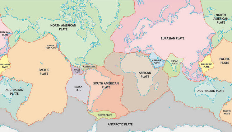
In the Great Chilean Earthquake, the western margin of the South American Plate lurched as much as 60 feet relative to the Nazca plate. The sudden breaking and fracturing of rocks along part of the Nazca Plate released built-up energy, leading to the earthquake.
The subsequent tsunami occurred due to the shock of the upward thrust caused by the Nazca plate pushing against the South American plate. This led to a wave which spread out in all directions.

Chile’s strategies for future earthquakes
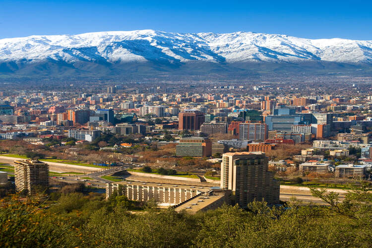
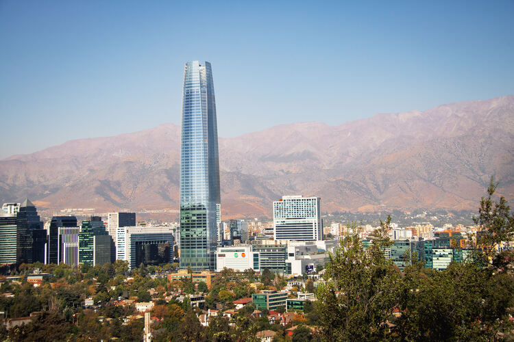
Since the Great Chilean Earthquake, Chile has adopted a national strategy to ensure new buildings, homes and offices are developed according to a seismic design code. Instead of resisting seismic waves during earthquakes, new buildings are designed to sway with them.
The magnitude 8.8 Chilean earthquake of 2010 led to widespread damage, causing a tsunami. Both events led to more than 500 deaths.
However, experts believe that the fortitude of the country’s buildings helped prevent a larger loss of life, compared to the magnitude 7.0 earthquake in Haiti in the same year which led to an estimated 220,000 deaths.
According to a 2011 report by the UN Office for Disaster Risk Reduction, these seismic design codes ‘continue to play a large part in protecting people’.
If you enjoyed this article subscribe to the Geographical Archive to see other world events from 1960.
Enjoying this article? We have thousands more for you.
Get immediate access to over 1,000 Geographical magazines in our archive back to 1935.
Sign up today and you will soon be travelling back through time reading all our amazing features of the last eight decades PLUS… you also get to enjoy every new issue of Geographical each month going forward in both print and digital formats.
Simply press the button below to choose the perfect package for you.