• Skip to main content
  • Skip to secondary menu
  • Skip to primary sidebar
  • Skip to footer
Geographical

Geographical

Official magazine of the Royal Geographical Society (with IBG)

  • Home
  • Briefing
  • Science & Environment
  • Climate
    • Climatewatch
  • Wildlife
  • Culture
  • Geopolitics
    • Geopolitical hotspots
  • Study Geography
    • University directory
    • Masters courses
    • Course guides
      • Climate change
      • Environmental science
      • Human geography
      • Physical geography
    • University pages
      • University of Aberdeen
      • Aberystwyth University
      • Cardiff University
      • University of Chester
      • Edge Hill University
      • The University of Edinburgh
      • Oxford Brookes University
      • Queen Mary University of London
    • Geography careers
      • Charity/non-profit
      • Education & research
      • Environment
      • Finance & consulting
      • Government and Local Government
    • Applications and advice
  • Quizzes
  • Magazine
    • Issue previews
    • Subscribe
    • Manage My Subscription
    • Special Editions
    • Podcasts
    • Geographical Archive
    • Book reviews
    • Crosswords
    • Advertise with us
  • Subscribe

Geo explainer: What is the ring of fire?

24 August 2022
2 minutes

Karangetang Volcano at Siau Island

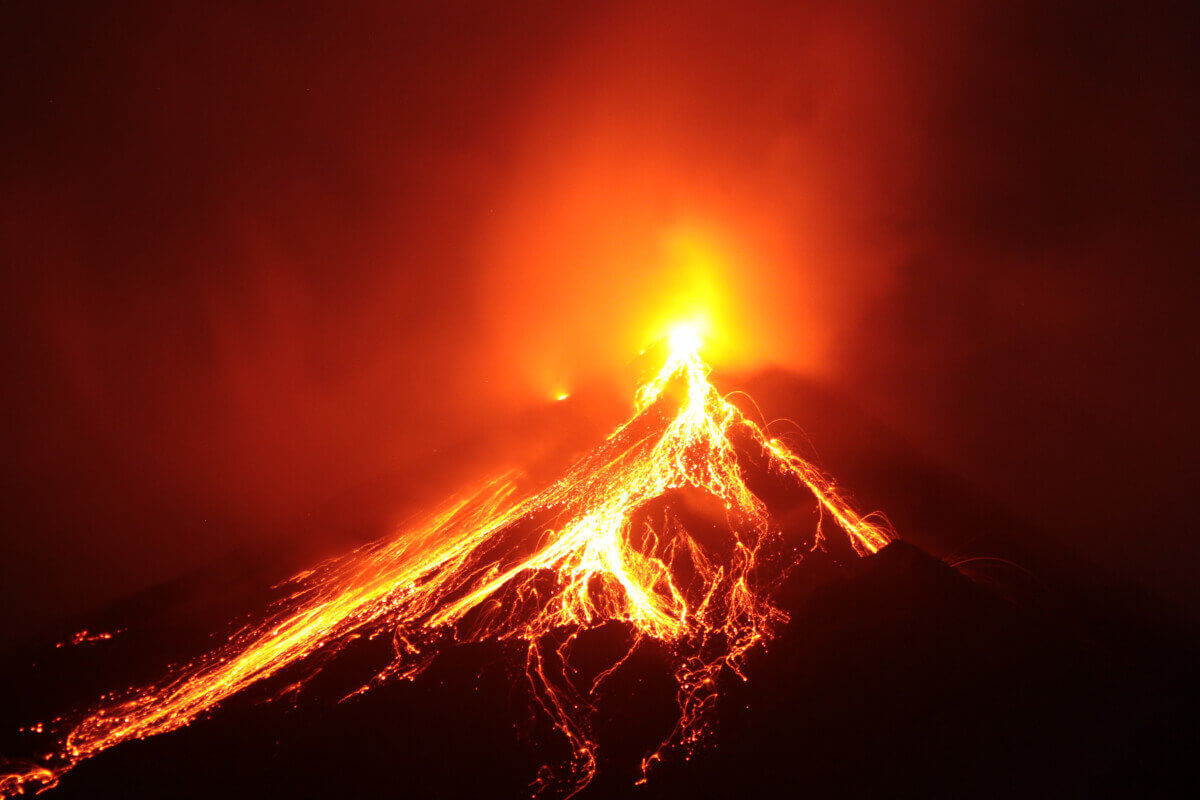
Ninety per cent of all earthquakes and 75 per cent of the world’s active volcanoes are concentrated along a 40,000 km line called the Ring of Fire.


By Bryony Cottam

Also known as the Circum-Pacific Belt, the Ring of Fire traces the boundaries of several tectonic plates – cracked segments of the lithosphere which form the earth’s outer shell. It almost fully encircles the Pacific Ocean in a horseshoe-shaped loop that begins at New Zealand and ends at the southern tip of South America.

As tectonic plates move, which they do constantly at a rate of between 3–5 cm a year, they collide, pull away or scrape against each other. This movement results in the violent volcanic and seismic activity that characterises the Ring of Fire. It’s best visualised by a map created by cartographer John Nelson which shows every earthquake with a magnitude of 4 or higher that occurred between 1898 and 2003, each one represented by a dot that is brighter or darker depending on its size.

Map of the Pacific Ring of Fire
Some of the most volatile volcanoes along the Ring of Fire. Image: Rainer Lesniewski/Shutterstock

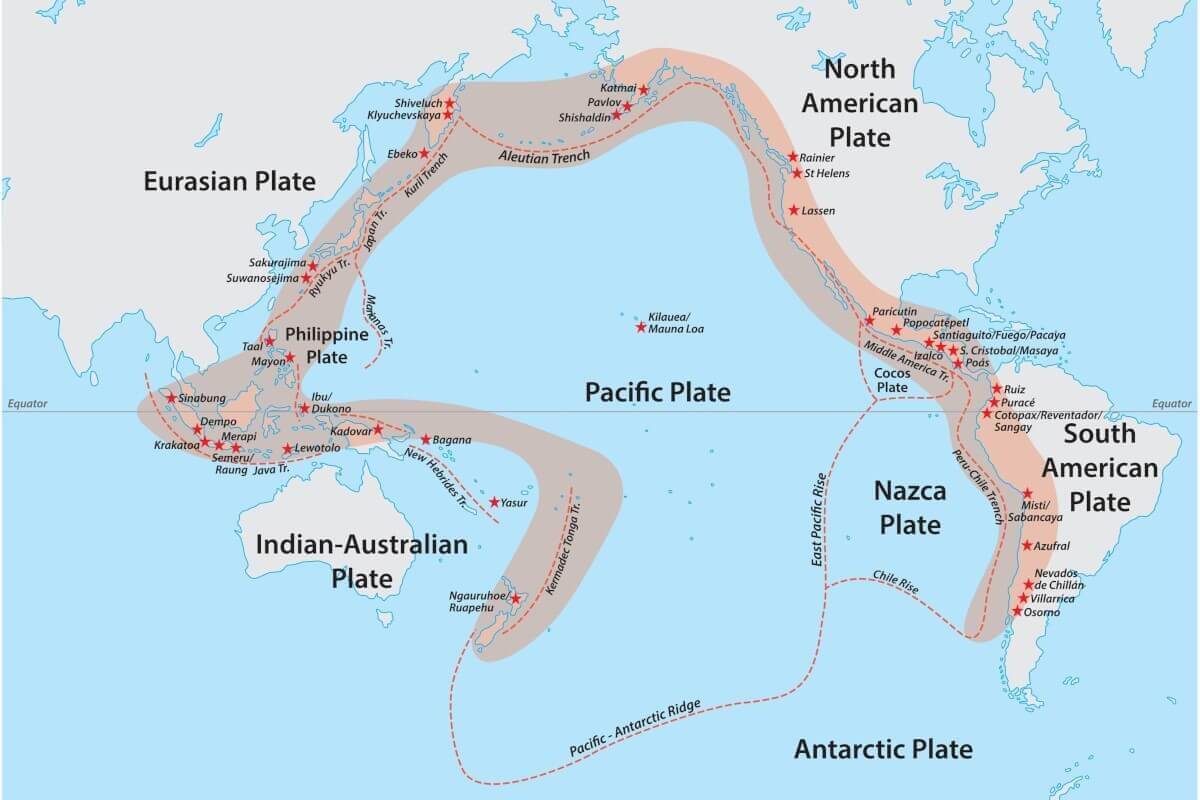
The cause of so much violent activity is the near-continuous series of subduction zones (where convergent plates collide and one is forced below the other) that surround the Pacific Plate beneath the ocean floor. In these areas, the rock melts and becomes magma, often resulting in a volcanic eruption. In other areas, these subduction zones create deep chasms in the seabed, and many of the deepest oceanic trenches, including the Mariana Trench, can be found here.

The main exception to this series of convergent plates is at the continental border between the Pacific and North American Plates, an area known as the San Andreas fault. This is a transform boundary, where the plates grind sideways against each other, creating friction that results in earthquakes.

A ‘great volcanic circle which girdles the pacific’ was first written about in the early 19th century and its path through continents and island chains is described in detail in the July 1878 edition of Scientific American. In these last 220 years alone the region has been responsible for several catastrophic natural disasters, such as the 1815 Mount Tambora volcanic eruption, the largest volcanic eruption in modern history, which produced enough ash to lower global temperatures, causing extreme weather and failed harvests. Most of the world’s strongest earthquakes take place here, including the strongest recorded earthquake in Valdivia, Chile, in 1960, and the undersea earthquake that triggered the Indian Ocean Tsunami in December 2004.

Filed Under: Science & Environment Tagged With: Earthquakes, Geo Explainer, Volcanoes

Protected by Copyscape

Primary Sidebar

Subscribe to Geographical Magazine from just £4.99

Geographical subscriptions

Sign up to our newsletter and get the best of Geographical direct to your inbox

Popular Now

Golden Visas – Who’s Buying Residency Around the World?

Golden Visas – Who’s Buying Residency Around the World?

Following in the footsteps of explorers: The Royal Geographical Society Collection

Following in the footsteps of explorers: The Royal Geographical Society Collection

nespresso machine

Business models that aren’t fit for every purpose

Joey Apachee’s family stands in front of the house he started building for himself and his two children before his death. From left to right: Joe’s mother, Virginia Apachee, daughter, Ashton, and son, Julian

Missing, murdered and forgotten: The Navajo families fight for justice

QUIZ: Urban Geography

QUIZ: Urban Geography

Footer

  • Facebook
  • Instagram
  • LinkedIn
  • Reddit
  • TikTok
  • Twitter
  • YouTube

Geographical print magazine cover

Published in the UK since 1935, Geographical is the official magazine of the Royal Geographical Society (with IBG).

Informative, authoritative and educational, this site’s content covers a wide range of subject areas, including geography, culture, wildlife and exploration, illustrated with superb photography.

Click Here for SUBSCRIPTION details

Want to access Geographical on your tablet or smartphone? Press the Apple, Android or PC/Mac image below to download the app for your device

Footer Apple Footer Android Footer Mac-PC

More from Geographical

  • Subscriptions
  • Get our Newsletter
  • About Us
  • Contact Us
  • Advertise with us
  • Privacy policy
  • Terms & Conditions

Copyright © 2025 · Site by Syon Media