
• Skip to main content
  • Skip to secondary menu
  • Skip to primary sidebar
  • Skip to footer
Geographical

Geographical

Official magazine of the Royal Geographical Society (with IBG)

  • Geographical Home
  • News
  • Features
  • Opinion
    • Climatewatch
    • Front Lines
  • Podcast
  • Travel
    • Discovering Britain
    • Passport
  • Culture
    • Book reviews
  • Quizzes
    • Crosswords
  • Choose Geography
    • University directory
    • Masters courses
    • Course guides
      • Climate change
      • Environmental science
      • Human geography
      • Physical geography
    • University pages
      • Aberystwyth University
      • Brunel University
      • Cardiff University
      • University of Chester
      • Edge Hill University
      • The University of Edinburgh
      • Newcastle University
      • Nottingham Trent University
      • Oxford Brookes University
      • The University of Plymouth
      • Queen Mary University of London
    • Geography careers
      • Charity/non-profit
      • Education & research
      • Environment
      • Finance & consulting
      • Government and Local Government
    • Applications and advice
  • Magazine
    • Issue previews
    • Subscribe
    • Manage My Subscription
    • Special Editions
    • Geographical Archive
    • Advertise with us
  • Subscribe
    • Direct Debit Changes

New type of landslide could impact northern altitudes, study finds

28 October 2026
3 minutes

Permafrost in the mountain
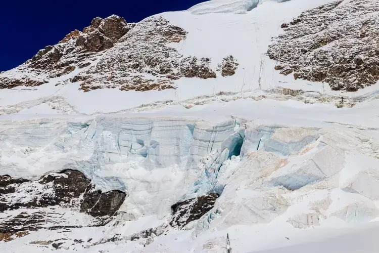
Permafrost is any ground that remains below freezing for at least two years. Image: Olya Solod/Shutterstock

Known as permafrost detachment slides, these landslides may be a long-term impact of wildfires


By Victoria Heath

Researchers have discovered a new type of landslide in Canada’s Northwest Territories, where large blocks of permafrost the size of a two-storey house break off and slide downhill.

These landslides, known as permafrost detachment slides, have not been seen before and appear to result from wildfires in northern latitudes.

In total, researchers found more than 150 instances of these landslides in the area, each typically moving more than one million cubic metres (35 million cubic feet) of land.

Researchers focused on two landslides, one in the Johnson River in 2017 that moved more than 18 million cubic metres (636 million cubic feet) of soil and rock. Another, located in the Redstone River Valley, moved around 4.5 million cubic metres (159 million cubic feet) of debris in 2018.

According to Joseph Young, lead author of the study published in Geophysical Research Letters and PhD student at the University of Alberta, wildfires began these ‘large and quick’ landslides, with the area burning ‘quite severely’ in 1995.


Enjoying this article? Check out our related reads…

  • Which countries use the most water per person?
  • Landslides are pulling the Congolese city of Bukavu apart
  • How landslides, droughts and monsoons are devastating an Indian state
  • The largest marine landslide causes internet outages in Africa
  • Arctic permafrost: a linear threat, not a planetary tipping point

Wildfires completely eradicate organic material, affecting the top layer of permafrost.

‘[Permafrost detachment slides] can move the amount of material, which would take standard ways of permafrost failure a few decades to reach, in a matter of days in some cases,’ said Young.

What is permafrost?

Permafrost, also known as permanently frozen ground, is soil, sand, sediment or rock that remains at or below 0°C for at least two years.

In total, permafrost covers about 23 million square kilometres (nine million square miles), or about 25 per cent of the Northern Hemisphere’s exposed land surface. Approximately 65 per cent of permafrost is found in Eurasia, while the other 35 per cent is in North America and Greenland.

As the planet warms due to climate change, microbes begin to decompose plant material in the soil, producing greenhouse gases such as carbon dioxide and methane that further warm the planet. Research shows that the volume of permafrost within the upper two metres of the ground will decrease by up to 40 per cent with every 1°C rise in global surface air temperature.
Ice permafrost
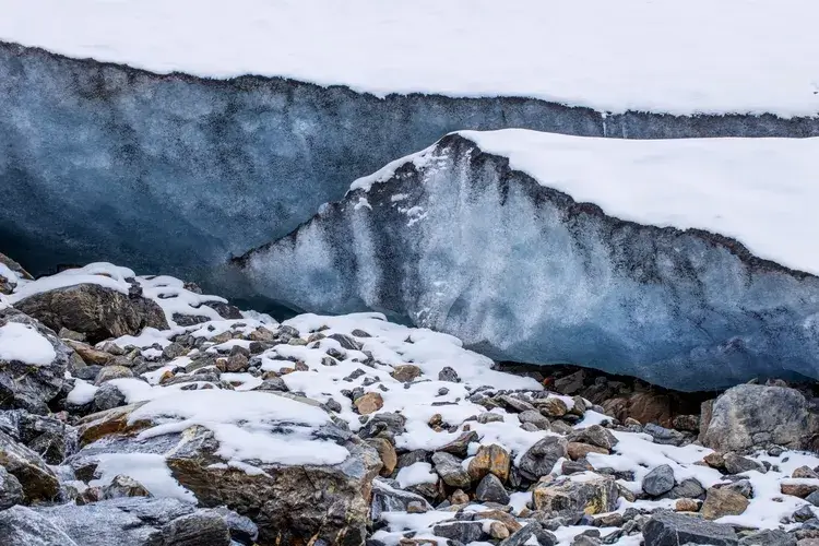
Permafrost covers around 25 per cent of the Northern Hemisphere’s exposed land surface. Image: Trifonov Aleksey/Shutterstock

This melting can destabilise the ground, affecting infrastructure and transport. If global warming continues, up to 50 per cent of critical infrastructure around the Arctic is expected to be at high risk by the middle of the century.

Thawing permafrost threatens humans and animals. Bacteria and viruses trapped in ice and soil can cause illness, and scientists have discovered microbes more than 400,000 years old in thawed permafrost.

Warmer years have been linked to a higher risk of previously frozen anthrax bacteria and anthrax outbreaks.
Themes Science & Environment Climate

Protected by Copyscape

Primary Sidebar

SUBSCRIBE

GEOGRAPHICAL WEEKLY LOGO FREE - Sign up to get context, clarity and perspective in a noisy world, every Friday

Popular Now

On The Ground: The Aberfan Tribunal

On The Ground: The Aberfan Tribunal

Shompen band traversing a river on Great Nicobar Island.

UN urges India to suspend controversial mega-project on Great Nicobar Island

3d globe inside digital scanning frame.

AI or climate change – which poses the greater threat to humanity?

A priest beside health workers in protective equipment outside a metal-walled building in Mongbwalu

Why war is making the DRC’s Ebola outbreak harder to stop

Copernicus Marine Service visualisations show the impact of Super Typhoon Champi on the Philippine Sea on 21 October 2026. With winds reaching 296 km/h, the Category 5 storm was the strongest tropical cyclone recorded in 2026. The images show the anticlockwise movement of wind-generated waves (left) and significant wave heights reaching 10 metres near the storm’s centre (right).

Typhoon Champi hits Taiwan

Footer

  • Facebook
  • Instagram
  • LinkedIn
  • Reddit
  • TikTok
  • Twitter
  • YouTube

Geographical print magazine cover

Published in the UK since 1935, Geographical is the official magazine of the Royal Geographical Society (with IBG).

Informative, authoritative and educational, this site’s content covers a wide range of subject areas, including geography, culture, wildlife and exploration, illustrated with superb photography.

Click Here for SUBSCRIPTION details

Want to access Geographical on your tablet or smartphone? Press the Apple, Android or PC/Mac image below to download the app for your device

Footer Apple Footer Android Footer Mac-PC

More from Geographical

  • Subscriptions
  • Get our Newsletter
  • About Us
  • Contact Us
  • Advertise with us
  • Privacy policy
  • Terms & Conditions

Copyright © 2026 · Site by Syon Media