
• Skip to main content
  • Skip to secondary menu
  • Skip to primary sidebar
  • Skip to footer
Geographical

Geographical

Official magazine of the Royal Geographical Society (with IBG)

  • Geographical Home
  • News
  • Features
  • Opinion
    • Climatewatch
    • Front Lines
  • Podcast
  • Travel
    • Discovering Britain
    • Passport
  • Culture
    • Book reviews
  • Quizzes
    • Crosswords
  • Choose Geography
    • University directory
    • Masters courses
    • Course guides
      • Climate change
      • Environmental science
      • Human geography
      • Physical geography
    • University pages
      • Aberystwyth University
      • Brunel University
      • Cardiff University
      • University of Chester
      • Edge Hill University
      • The University of Edinburgh
      • Newcastle University
      • Nottingham Trent University
      • Oxford Brookes University
      • The University of Plymouth
      • Queen Mary University of London
    • Geography careers
      • Charity/non-profit
      • Education & research
      • Environment
      • Finance & consulting
      • Government and Local Government
    • Applications and advice
  • Magazine
    • Issue previews
    • Subscribe
    • Manage My Subscription
    • Special Editions
    • Geographical Archive
    • Advertise with us
  • Subscribe
    • Direct Debit Changes

How satellites can reveal the hidden impacts of war

11 September 2026
2 minutes

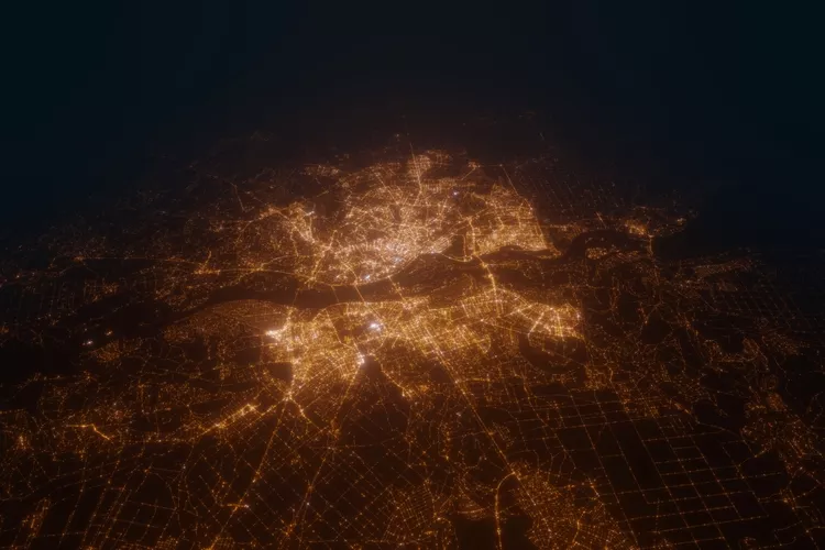
Ukraine from satellite perspective
Ukraine from above. Image: Shutterstock

Combining satellite data with traditional media reporting can help shed light on underreported aspects of conflicts


By Victoria Heath

An international research team has shown how satellite data can help conflict research in war zones, providing a more comprehensive picture of conflicts.

Published in Nature, the research team, including researchers from the University of Zurich (UZH), has highlighted the benefits of using satellite data in tandem with text-based data such as media reporting. Satellite data is able to reveal developments which may only feature in limited ways in reporting, such as identifying areas of destroyed crops or damaged buildings.


Enjoying this article? Check out our related reads…

  • Millions of satellites poised to enter space pose ‘grave threat’ to night skies
  • A collision course with space junk
  • Penguin poop seen from space reveals stark reality for future of iconic polar species
  • The growing threat of space junk around Earth
  • Ordnance Survey adds geological data to its Data Hub

Until now, conflict research has relied primarily on text-based data which is often, as the research team say, ‘attention-driven’. Consequently, this means there is a lack of reliable data from places and periods which receive little media coverage and are ‘beyond the media spotlight’, as well as from types of events that often go underreported.

In addition, quantitative studies of conflict-related violence tend to mostly focus on fatalities, leaving other aspects of violence – and its social and environmental effects – undisclosed.
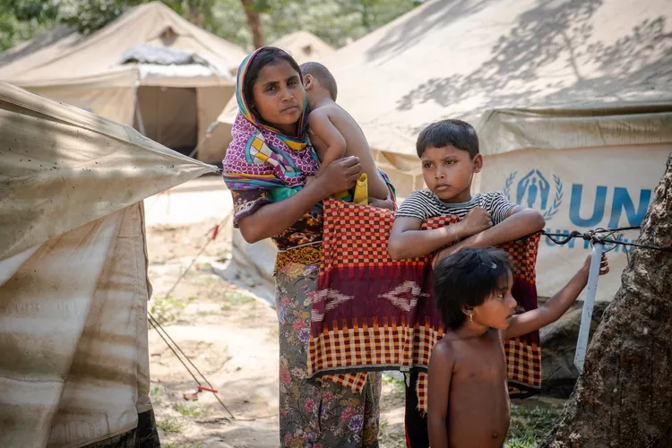
Rohingya refugees at the Kutupalong transit center April 16, 2018 in Cox's Bazar, Bangladesh.
Rohingya refugees at the Kutupalong transit center April 16, 2018 in Cox’s Bazar, Bangladesh. Image: Shutterstock

To come to their conclusions, researchers used empirical examples from Ukraine and Myanmar. In Ukraine, researchers linked satellite-derived data on damaged buildings alongside text-based data. By combining these two data sources, it became apparent that significantly more buildings were damaged in areas captured by Russian forces compared to areas recaptured by Ukranian forces.

In addition, satellite data also helped to paint a clearer picture of the impacts of destruction in Myanmar. The targeted decimation of Rohingya homes continued long after the massacres had ended – an example of violence often unreported in text-based data.

‘In the longer term, the two data sources could be modelled jointly to identify patterns of violence that would otherwise remain hidden from us,’ said Professor at the Department of Mathematical Modeling and Machine Learning Jan Dirk Wegner.

The researchers remain hopeful that their new research could be valuable to organisations worldwide.

‘Combining satellite-derived and text-based data allows international organizations such as the UN or the ICRC to better assess the consequences of armed conflicts, identify particularly affected regions more quickly, and target humanitarian assistance more effectively,’ said professor of digital democracy at the University of Zurich Karsten Donnay.

Themes News Asia Conflict Ukraine

Protected by Copyscape

Primary Sidebar

SUMMER SALE

GEOGRAPHICAL WEEKLY LOGO FREE - Sign up to get context, clarity and perspective in a noisy world, every Friday

Popular Now

Review: The Savage Landscape by Cal Flyn

Review: The Savage Landscape by Cal Flyn

QUIZ: Geography Extremes

QUIZ: Geography Extremes

Mount Etna erupting

Ancient supervolcano found in England

QUIZ: Flags of the World – South America

QUIZ: Flags of the World – South America

Ukraine destroyed building

The unseen geography of Ukraine’s reconstruction

Footer

  • Facebook
  • Instagram
  • LinkedIn
  • Reddit
  • TikTok
  • Twitter
  • YouTube

Geographical print magazine cover

Published in the UK since 1935, Geographical is the official magazine of the Royal Geographical Society (with IBG).

Informative, authoritative and educational, this site’s content covers a wide range of subject areas, including geography, culture, wildlife and exploration, illustrated with superb photography.

Click Here for SUBSCRIPTION details

Want to access Geographical on your tablet or smartphone? Press the Apple, Android or PC/Mac image below to download the app for your device

Footer Apple Footer Android Footer Mac-PC

More from Geographical

  • Subscriptions
  • Get our Newsletter
  • About Us
  • Contact Us
  • Advertise with us
  • Privacy policy
  • Terms & Conditions

Copyright © 2026 · Site by Syon Media