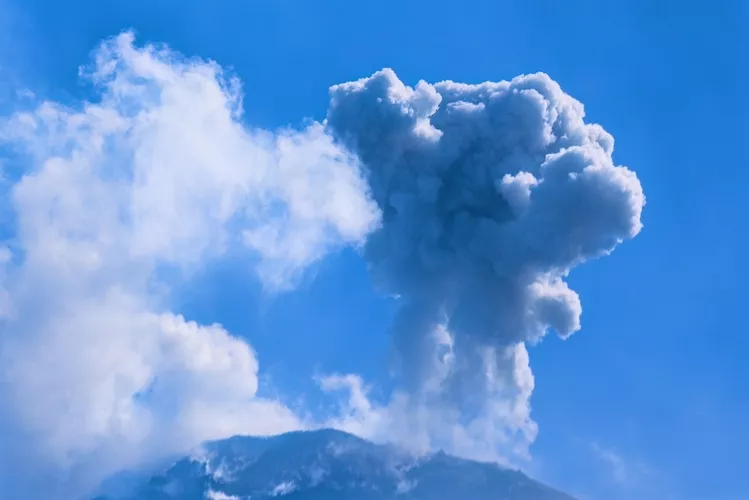
A key telltale sign of an impending eruption goes unmonitored at thousands of volcanoes worldwide. Scientists are trying to change that
By
On 3 April 1991, US missionary Sister Emma Fondevilla, who had been living in a village of Indigenous Aeta people on the flanks of Mount Pinatubo, set up a meeting between residents and scientists from the Philippine Institute of Volcanology and Seismology (PHIVOLCS). A few days earlier, Fondevilla and the villagers had noticed steam streaming from vents on the northwestern side of the mountain, accompanied by a strong smell of rotten eggs. It was 73 days before a colossal eruption would begin.
Mount Pinatubo is a stratovolcano on Luzon, the largest of the Philippine islands, with a long history of highly explosive activity — but by the 1990s, it had lain dormant for hundreds of years. Its once-conical slopes were heavily eroded and covered in dense rainforest. To most people living nearby, it looked like an ordinary mountain. But under the direction of Philippine volcanologist Raymundo Punongbayan, PHIVOLCS scientists installed preliminary seismographs to verify the villagers’ accounts. Within 24 hours, the data they were collecting had started to set off alarm bells.
Enjoying this article? Check out our related reads…
While villages within ten kilometres of the summit were being evacuated, scientists began investigating whether the activity they were recording was truly volcanic and whether an eruption was likely, or whether it was purely hydrothermal — normal activity for the area.
Punongbayan later wrote that a complete lack of baseline monitoring for Pinatubo, with ‘no information of any kind about the precursors of its previous eruptions’, made this task difficult. But on 5 June, amid increased seismic activity and what Punongbayan described as an ‘ominous, sudden decrease in SO2 emissions’, authorities began evacuating another 60,000 people. Ten days later, two days after the last evacuation was completed, Pinatubo erupted. Five cubic kilometres of ash and rock — enough to fill Sydney Harbour nine times over — were thrown 40 kilometres into the sky.
On any given day of the year, some 40 to 50 volcanoes around the world are erupting. At the time of writing, these include volcanic systems across Ecuador, Italy, Indonesia, Mexico, Peru, the Philippines and the USA.
When volcanic activity escalates near populated regions, scientists and civil authorities must continuously assess the hazards to determine whether the difficult decision to evacuate must be made. While coordinated local efforts enabled the unprecedented success of the 1991 Mount Pinatubo evacuation, it ultimately relied on what Punongbayan noted was a ‘brief but unmistakable warning’ from the volcano itself. It’s one that many equally at-risk communities might not get.
‘I think there’s a misconception that volcanoes are well monitored,’ says Tom Pering, a senior lecturer in volcanology at the University of Sheffield. Some are, he adds — notably Mount Etna, which is surrounded by an array of seismic stations, borehole tiltmeters, gas sensors and high-resolution cameras. Still, about 90 per cent of the world’s active volcanoes — numbering roughly 1,500 — lack continuous ground-based monitoring. And while monitored volcanoes are usually equipped with seismometers, Pering adds that gas-sensing equipment is often ‘far more restricted’.
Before the climactic events of June 1991, instruments on Mount Pinatubo captured a dramatic shift in sulphur dioxide degassing — an escalation first noticed by the Aeta. Emissions surged to around 4,500 tonnes per day in late May before plummeting to 230 tonnes, a sudden drop that signalled a blocked conduit and a dangerous build-up of pressure. Pering says that while a wide suite of parameters — including seismic activity and ground deformation — can be used to track volcanic activity, ‘gases are often the first sign that something may be changing in a volcanic system’. Volcanologists call them ‘telegrams from the Earth’s interior’.
As magmas rise within the crust, they naturally release different gases at different depths. Carbon dioxide, which has very low solubility in molten rock, often begins to form bubbles at depths of ten to 30 kilometres or more.
In contrast, sulphur dioxide remains dissolved in magma until it reaches much shallower depths — just a few kilometres below the surface. ‘It’s a useful warning tool that lets you know there could be an impending eruption,’ says Pering.
With many gas-measuring instruments costing tens or even hundreds of thousands of pounds — a major barrier to wider monitoring, especially in the Global South — Pering has been working on an alternative.
The solution relies on technology most of us already carry in our pockets — the sensors inside everyday phones. ‘Most of the cameras you get are designed for visible light, but we’re not interested in that,’ he explains. ‘We’re interested in ultraviolet light, because sulphur dioxide absorbs it.’
By modifying a phone camera — costing as little as £20 — using a chemical process that makes it sensitive to UV light, and pairing it with a Raspberry Pi — an affordable computer the size of a debit card — Pering has created a device that is significantly cheaper than existing UV cameras.
The resulting image reveals sulphur dioxide in the volcanic plume as a dark cloud against a bright background. By comparing it with a reference image captured at a different wavelength, the device then calculates the UV absorption strength at each pixel to determine the gas concentration.
In 2018, Felipe Aguilera — director of the Chilean volcanic-risk institute Ckelar Volcanes — reached out to Pering about the new mobile cameras. ‘We asked whether we could acquire one, and they told us they could deliver some and start to test them in this new environment.’ At the time, Pering and his team were still focused on more accessible volcanoes such as Mount Etna and Stromboli in Italy. But Aguilera notes that Chile presented a much tougher testing ground, particularly on volcanoes such as Lastarria. ‘It’s a hyperarid area with virtually no rain at all,’ Aguilera says. ‘Working here also presents unique challenges, particularly regarding humidity and atmospheric light dispersion.’

Challenging conditions aside, Pering says Lastarria is a particularly fascinating volcano to study, and one that is notoriously difficult to monitor via satellites — another commonly used method. ‘When you measure it from the ground, there’s quite a bit of gas coming out all the time.’ That’s not to say, he adds, that Lastarria is at risk of an eruption anytime soon. ‘If you were to turn up one day with a UV camera or other gas-sensing equipment, you might think: Oh, that’s quite high. But that doesn’t give you the full picture.’
Pering often tells his students that every volcano has its own personality. To really understand that personality, you need to know what it’s doing in the lead-up to an eruption, during an eruption and after an eruption — but also when it’s quiet. It’s this broader view of Lastarria — and the dozen other volcanoes being monitored across northern and southern Chile — that Aguilera hopes to bring into focus.
Earlier this year, Pering founded VolcanoTech, a spin-out company from the University of Sheffield. His goal, he says, is to further reduce the cost of building the mobile UV cameras — by being able to buy components in bulk, for example. Work also continues on making the data processing more user-friendly, although Pering notes that current support goes beyond simply handing over equipment; the team often travels to observatories to provide hands-on training and exchange knowledge. For researchers such as Aguilera — working in regions where tens of thousands of people live in the shadow of active volcanoes — gathering these measurements is a vital task.