Project used artificial intelligence to transform around 100,000 pages of handwritten records into online interactive maps
By
Historians have compiled a new interactive map showing 400 years of Britain’s shipping trade by using artificial intelligence to read through around 100,000 pages of handwritten records.
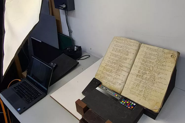
The project, headed by the University of Southampton, used artificial intelligence to extract data from handwritten ‘port books’ that documented an unbroken 200-year record of individual voyages, ports, ships, shipmasters and cargoes from 1565 onwards.
Specialist software scanned around 100,000 pages from leather-bound parchment books to recognise the text and learn and compile information.
‘This was a massive task, completed on a scale not seen before,’ said historian and lead researcher Professor Craig Lambert from the University of Southampton. ‘Without AI extracting and organising the data, this would have taken years. It still needed manual checking, but it sped up the process enormously.’
Enjoying this article? Check out our related reads…
‘We taught AI to read the unique handwriting belonging to many different port officials and also the change in spelling of words across the decades.’
Recording hundreds of thousands of voyages, including information about ships, ports, sea routes and goods, the project revealed that Europe accounted for the majority of Britain’s overseas trade.
Taking 1696–1697 as an example, European markets accounted for around 80 per cent of the recorded value of England’s overseas trade.
‘It’s interesting to note that even centuries ago, Europe was Britain’s principal overseas trading region, and although Britain had important global connections, most of its core trade was still being done closer to its own shores,’ said associate professor of history and co-lead Dr John McAleer.
Researchers also discovered what exactly was being traded. Coal was the top commodity, closely followed by ale. Popular items also included children’s toys, sheep guts and bowstrings, along with a modern remedy believed to cure almost any ailment, known as ‘Venice treacle’.
Of the top 15 countries by number of recorded maritime locations connected to British trade, 10 were in Europe. France ranked highest with 157 identified maritime sites, followed by the Netherlands with 68. India ranked third with 59.
In Britain, the south-west dominated merchant shipping activity, accounting for 426 recorded maritime locations across the centuries. The southeast followed next, with 306 identified sites. Scotland accounted for 98 recorded maritime locations. Across the wider London and Thames maritime zone, researchers identified 135 ports, wharves, and landing places.