
• Skip to main content
  • Skip to secondary menu
  • Skip to primary sidebar
  • Skip to footer
Geographical

Geographical

Official magazine of the Royal Geographical Society (with IBG)

  • Geographical Home
  • News
  • Features
  • Opinion
    • Climatewatch
    • Front Lines
  • Podcast
  • Travel
    • Discovering Britain
    • Passport
  • Culture
    • Book reviews
  • Quizzes
    • Crosswords
  • Choose Geography
    • University directory
    • Masters courses
    • Course guides
      • Climate change
      • Environmental science
      • Human geography
      • Physical geography
    • University pages
      • Aberystwyth University
      • Brunel University
      • Cardiff University
      • University of Chester
      • Edge Hill University
      • The University of Edinburgh
      • Newcastle University
      • Nottingham Trent University
      • Oxford Brookes University
      • The University of Plymouth
      • Queen Mary University of London
    • Geography careers
      • Charity/non-profit
      • Education & research
      • Environment
      • Finance & consulting
      • Government and Local Government
    • Applications and advice
  • Magazine
    • Issue previews
    • Subscribe
    • Manage My Subscription
    • Special Editions
    • Geographical Archive
    • Advertise with us
  • Subscribe
    • Direct Debit Changes

How does solar heat cause earthquakes?

30 April 2025
2 minutes

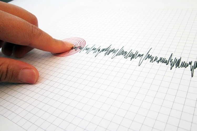
Seismograph and earthquake. A hand pointing at a seismograph recording the seismic activity of an earthquake
A hand pointing at a seismograph recording the seismic activity of an earthquake. Image: Shutterstock

Discover the relationship between the planet’s earthquake activity and solar heat


By Bryony Cottam

We understand how earthquakes happen, but predicting when a seismic event will occur remains a major challenge for scientists. Factors that play a role include rock strength and the presence of faults or weak layers in the rock succession. Recently, researchers have been investigating other, more subtle factors – from lunar cycles and weather to a surprising new possibility: the influence of solar heat.


Enjoying this article? Check out our related reads:

  • Geo explainer: What is the solar cycle and how does it affect us?
  • Major solar storms could produce exceptional aurora events
  • Geo Explainer: The bright future of solar power
  • Solar energy breakthrough could reduce need for solar farms
  • Solar power breakthrough using perovskite

In 2022, computer scientist Matheus Henrique Junqueira Saldanha and colleagues at the University of Tsukuba, Japan, first discovered a link between solar and seismic activity. In a new study, published in the AIP Publishing journal Chaos, they propose that the Sun warming the Earth’s surface could be the key to this link. ‘Solar heat drives atmospheric temperature changes, which in turn can affect things like rock properties and underground water movement,’ explains Junqueira Saldanha.

These fluctuations, he suggests, could contribute to making rock more brittle and prone to fracturing, while changes in rainfall and snowmelt can affect the pressure on tectonic plate boundaries.

To conduct the study, the team analysed earthquake data alongside solar activity and surface temperature records. They discovered that incorporating Earth surface temperatures into their models improved forecasting accuracy, especially for shallow earthquakes (occurring within 70 kilometres of the surface).

This implies that the transfer of solar heat to the Earth’s surface does play a role in seismic activity – even if only a small one. ‘It’s an exciting direction,’ says Junqueira Saldanha, ‘and we hope our study sheds some light on the bigger picture of what triggers earthquakes.’

Themes News Earthquakes

Protected by Copyscape

Primary Sidebar

SUBSCRIBE

GEOGRAPHICAL WEEKLY LOGO FREE - Sign up to get context, clarity and perspective in a noisy world, every Friday

Popular Now

On The Ground: The Aberfan Tribunal

On The Ground: The Aberfan Tribunal

Shompen band traversing a river on Great Nicobar Island.

UN urges India to suspend controversial mega-project on Great Nicobar Island

3d globe inside digital scanning frame.

AI or climate change – which poses the greater threat to humanity?

A priest beside health workers in protective equipment outside a metal-walled building in Mongbwalu

Why war is making the DRC’s Ebola outbreak harder to stop

Copernicus Marine Service visualisations show the impact of Super Typhoon Champi on the Philippine Sea on 21 October 2026. With winds reaching 296 km/h, the Category 5 storm was the strongest tropical cyclone recorded in 2026. The images show the anticlockwise movement of wind-generated waves (left) and significant wave heights reaching 10 metres near the storm’s centre (right).

Typhoon Champi hits Taiwan

Footer

  • Facebook
  • Instagram
  • LinkedIn
  • Reddit
  • TikTok
  • Twitter
  • YouTube

Geographical print magazine cover

Published in the UK since 1935, Geographical is the official magazine of the Royal Geographical Society (with IBG).

Informative, authoritative and educational, this site’s content covers a wide range of subject areas, including geography, culture, wildlife and exploration, illustrated with superb photography.

Click Here for SUBSCRIPTION details

Want to access Geographical on your tablet or smartphone? Press the Apple, Android or PC/Mac image below to download the app for your device

Footer Apple Footer Android Footer Mac-PC

More from Geographical

  • Subscriptions
  • Get our Newsletter
  • About Us
  • Contact Us
  • Advertise with us
  • Privacy policy
  • Terms & Conditions

Copyright © 2026 · Site by Syon Media