
A centuries-old temple, a disputed map and a border still bristling with tension…

By
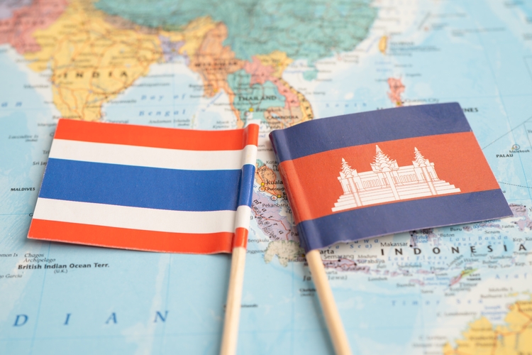
I’ll see your map – and raise you mine.’ That’s roughly what the governments of Thailand and Cambodia said last month before opening fire with heavy artillery across their shared border. It’s a familiar refrain in territorial disputes around the world and, as usual, behind it were history, geography, emotion, internal politics – and maps.
This dispute goes back almost 1,000 years and, among other things, involves the 1,000-year-old Preah Vihear temple, built during the golden age of the Khmer Empire.
It stands in the Dangrek mountains on the borders of modern-day Cambodia and Thailand.
Enjoying this article? Check out our related reads:
The empire ruled large parts of mainland Southeast Asia, including most of Siam (Thailand), but after its collapse in the 13th century, what is now called Cambodia was repeatedly invaded by Siam.
In 1904, Cambodia’s French colonial overlords signed a partial border treaty with Siam, which, based on the dividing ridge between drainage areas, suggested Preah Vihear was in Siam.
However, the text didn’t make it clear, and in 1907, French officials produced a topographical map in which the border deviated from the watershed, putting all of the land around the temple in Cambodia. During the Second World War, Siam – now called Thailand – seized
Preah Vihear before losing it again. Following Cambodia’s independence in 1953, a series of border conflicts ensued, leading to the UN’s International Court of Justice (ICJ) ruling in favour of the temple being in Cambodia, but it didn’t make clear which country owned the larger disputed area around it.

Since then, each side has produced maps showing the territory as being in its country. Cambodia favours the 1907 French map; Thailand doesn’t.
Under international law, a map is considered legally binding on other states if it is part of a treaty between those states, or if the state which didn’t make the map issues a statement saying that it accepts it.
There’s also something called ‘admission against interest’. An example would be if a state that previously claimed an island issued a map in which the island was shown as belonging to another country. This is rare, but legally binding.
Disputes can be taken to the ICJ, which employs expert cartographers and historians to assess the integrity of maps. It helps if both parties agree in advance that they will be bound by the ICJ’s verdicts.
Subscribe to Tim Marshall’s Substack here: https://substack.com/@itwitius
A well-known case is the border dispute between Burkina Faso (then called Upper Volta) and Mali. In 1986, the court determined that maps – both modern and historical – were valid as evidence, although not to be considered binding unless both parties accepted this. They did, and they accepted the rulings marking their borders.
Another forum for disputes is the International Tribunal for the Law of the Sea (ITLOS), which draws on the United Nations Convention on the Law of the Sea (UNCLOS). China’s expansive claims on the South China Sea keep the ITLOS busy. In 2023, Beijing released a new map showing 90 per cent of the sea as Chinese territory.
Vietnam, Malaysia and the Philippines immediately turned to UNCLOS to rebuff the claims. For its part, Beijing – aware of the potential legal weight of maps – prohibits any map not drawn up by the state from being published in China.
Cambodia and Thailand aren’t so draconian, although Cambodia is on the road to becoming a one-party state after its leader for 38 years, Hun Sen, made his son, Hun Manet, prime minister in 2023.

However, like China, they do have maritime territorial issues. Each country claims the same large area in the Gulf of Thailand, which is rich in oil and gas.
Both also have a fear of losing territory, which is based on historical experience and plays into how quickly nationalist rhetoric is deployed during times of tension by the respective governments.
Thailand lost land it controlled in parts of what are now Laos and Cambodia under military threats from France, and parts of what is now Malaysia under pressure from Britain. Some historians argue that this was European colonisers taking land from the Siamese colonisers.
Either way, the sense of loss is real, and the territorial disputes are genuine issues, even
if both sides use them to further domestic political aims.
In Thailand, the border clashes have been used to weaken the politically and economically powerful Shinawatra family, while in Cambodia, the economy is in trouble and Hun Sen – current president of the senate after his son’s elevation, and still the dominant figure in the country’s politics – has been rallying the nation around the flag, and himself as its leader.
Neither side wants all-out war. Cambodia’s territory, population, economy and military are all smaller than Thailand’s, while Thailand is already dealing with an ethnic insurgency in its south and tensions on the border with Myanmar.
Nevertheless, as long as they dispute which map is legitimate, the danger will remain.