Rory Walsh journeys through the vast history behind London’s East End and explores the city’s Tower Hamlets
By
Walk • Urban • Greater London • Web Guide
As someone who grew up (and still lives) in London’s suburban southwest, the city’s East End seems almost mythical. One reason is its unfamilarity. Another is that I’ve mostly encountered it second-hand via fictional sources, from Sherlock Holmes stories to episodes of EastEnders. East End clichés abound.
But beyond the stereotypes, there is, of course, a real place. The East End developed from the growth of London’s docks, and the area has evolved ever since. This trail, created by writer Tom Bolton, searches for the ‘lost East End’, from lost people, buildings and streets to entire communities and ways of life.
The quest begins on a bright October morning. Tower Hill station is busy. It’s midweek but half term, and there are already queues outside the Tower of London. While crowds cross the road towards the river, the trail turns left.
A few minutes later, on Royal Mint Street, little red DLR trains rumble over dark Victorian railway arches. Tucked beyond the Artful Dodger pub and the Jack the Ripper Museum is Wilton’s Music Hall. Weathered yet ornate, the yellow and pink façade, looks almost Mediterranean. Yet this is firmly East End territory.
Wilton’s is one of London’s last traditional music halls. Established in 1858, it stood derelict for decades after the Second World War. The restored venue is often used now for filming period dramas. Surrounded by a large modern estate, the building is halfway along Graces Alley. This narrow passage is all that survives of Wellclose Square. In the late 17th century, a Danish and Norwegian church was built in the centre. For 200 years, the small community of Wellclose was the heart of Scandinavian London.
Enjoying this article? Discover Rory’s other city adventures…
Scandinavians settled in East London due to the Baltic timber trade passing through the docks. In 1729, a Swedish chapel joined the Danish church. From Graces Alley, a zigzag through the estate finds Swedenborg Gardens. Three giant tower blocks stretch overhead. The leafy park, named after Swedish inventor Emmanuel Swedenborg, was where the 1920s. The font still survives.
Full of rainwater and garlanded by fallen leaves, it’s a poignant memorial to a vanished Norse neighbourhood.
Another record of the past appears near St George in the East, one of Nicholas Hawksmoor’s six immense and unusual London churches. Beside the church grounds, the trail pauses at the Battle of Cable Street Mural.
On 4 October 1936, the British Union of Fascists, led by Oswald Moseley, planned to march through Jewish areas of the East End. At Cable Street, 100,000 people gathered to prevent them. After fierce fighting, which saw a bus overturned to create a barricade, Moseley’s fascists retreated.
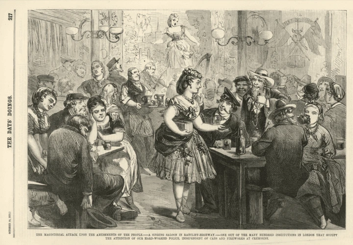
While the defeat of Moseley’s march was a source of pride, other aspects of the East End horrified observers. From the Victorian era especially, the area developed a lurid reputation. The rapid growth of London’s docks created serious overcrowding and squalor.
Poverty, disease, alcoholism and prostitution were widespread. As recently as 1966, writer Ian Nairn described Cable Street as ‘a shameful blot on the moral landscape of London; an outgrown slum’.
The East End’s rise and fall stemmed from the lie of the land. By the 18th century, the Pool of London was the world’s busiest port. As the capital’s maritime trade grew, new facilities were needed to handle increasing amounts of goods, especially from the British Empire.
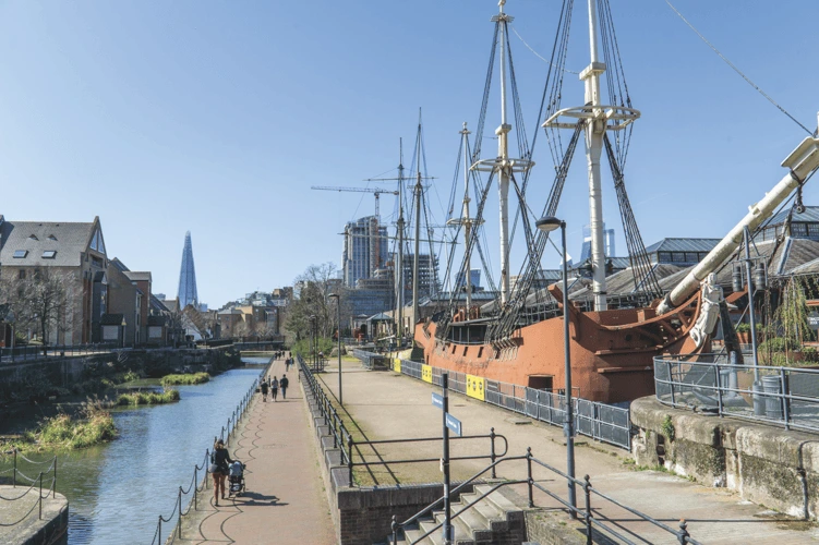
On the north bank of the Thames, east of the Tower of London, were large areas of marsh dotted with small settlements. These ‘Tower hamlets’ – including Wapping, Shadwell and Limehouse – transformed rapidly after a network of docks, basins and canals was dug into the marshes. Among them was Tobacco Dock, completed in 1812 to store tobacco and spirits.
By law, these expensive taxable imports were kept in secure ‘bonded’ warehouses to prevent theft. Tobacco Dock is still ringed with massive brown walls, looming like a cliff face.
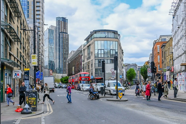
During the Second World War, the docks became a military target and the East End suffered severe bombing. Then, from the 1960s, containers and larger ships led the enclosed docks to decline. After London’s docks shut, the East End gradually experienced another change: regeneration. At Shadwell Basin, modern housing lines the quaysides. Old landmarks remain, however.
Opposite the basin bridge is the Prospect of Whitby, publicised as London’s oldest riverside pub. Dated to 1520, it was originally called the Pelican. Following a fire, it was rebuilt and renamed after a Newcastle coal boat which berthed outside. Once an infamous smugglers’ haunt, the pub is a thriving visitor attraction.
From this famous pub, the trail follows the Thames Path through an almost forgotten area. Ratcliffe was London’s first port. Known locally as ‘Sailor Town’, its name derived from a sandstone headland (‘red cliff ’).
From at least the Tudor period, Ratcliffe was where generations of sailors, merchants and migrants first set foot in the East End. Others made the opposite journey, setting sail from Ratcliffe for unchartered waters. Among them were Tudor explorers Hugh Willoughby and Martin Frobisher. In King Edward Memorial Park, a colourful tablet records their exploits.
When the Thames Path meets Narrow Street, a metal gate appears and wooden steps lead directly to the river. Ratcliffe Cross Stairs are one of the few remains of London’s lost port. Luckily, the tid is out and I can go onto the beach below. As Thames Clippers burble past, the distant towers of Canary Wharf glisten in the afternoon sun. My sole companions are a group of geese, dozing beside the lapping waves. It’s blissful. Only the incoming tide moves me on.
Back on dry land, the trail continues into Limehouse. Flanked by tall buildings, Narrow Street runs parallel to the Thames. Archaeologists suggest the road marks a medieval river wall, built to reclaim marshland. Hotels, apartments and converted warehouses line the pavements, along with a Gordon Ramsay restaurant. The area feels affluent and expensive.
Yet Limehouse was one of the East End’s poorest and most notorious places. In 1832, London’s first case of cholera was recorded in Limehouse. Victorian social surveyor Charles Booth reported ‘a nest of brothels frequented by common seamen of every nationality’.
A particular group of overseas visitors added to Limehouse’s notoriety. Among the East India Company’s imports through the docks were Chinese tea and spices. By the 1890s, Limehouse was home to London’s original Chinatown. These exotic settlers fascinated and frightened contemporary society. Newspapers featured salacious accounts of gambling, violence and opium dens.
In September 1940, Limehouse was severely bomb damaged. After the Chinese community moved to Soho, Chinatown was eventually cleared and rebuilt.
Today the only remains of Limehouse’s Chinatown are road names near Westferry DLR station, including Pekin Street and Canton Street. The trail concludes at Amoy Place, a quiet alley behind Limehouse police station. Ironic, given Chinatown was often depicted as loud and lawless.
This trail is marked by losses: vanished neighbourhoods, demolished buildings, people long departed. Following the route was also full of gains. Interesting and enjoyable, it made the real East End feel less like the mythical Wild West.

Go to the Discovering Britain website to find more hikes, short walks, or viewing points. Every landscape has a story to tell!