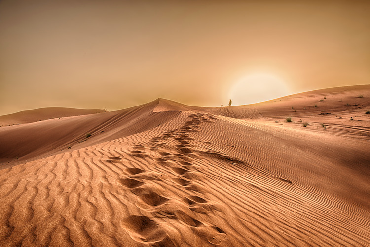
Covering around 20% of the Earth’s surface, deserts are vast & harsh landscapes. From the Sahara to the Arctic, we delve into their formation
By Susanne Gough
Deserts all have one thing in common: they are dry. To be defined as a desert, an area must receive less than 12.5 centimetres of rainfall a year. Though many deserts reach scorching temperatures by day, heat is largely irrelevant – the Sahara reaches freezing temperatures by night, and the Arctic and Antarctic ice caps qualify as polar deserts. There are many different types of deserts, and how they were formed dictates their type, whether subtropical, rain shadow, interior, coastal, or polar.
Beyond their formation processes, deserts have histories. When were they formed is as rich a question as how, delving into the human and climactic origins of our driest biome in deep time. And desertification is still happening today. Alongside the plethora of ways our environment is transforming in this era of the climate crisis, deserts are no exception. But how can we prevent and stem the damage of these changes? And how are indigenous desert communities leading the way?
Subtropical deserts
Occurring between fifteen and thirty degrees north and south of the equator (areas also known as the Tropic of Cancer and the Tropic of Capricorn, respectively), subtropical deserts are the arid, comparably barren neighbours of their wet, equatorial rainforest counterparts. The Sahara, the largest hot desert on earth at 9.2 million square kilometres and unquestionable A-lister of the desert world, is subtropical.
The Chihuahuan, Sonaran and Mojave deserts in the United States are all classified as subtropical deserts.
These deserts are formed by air currents. Hot air rising from the equator loses its moisture in the process, producing clouds and rain, which give rainforests their name. This now dry air cools and descends, generating an arid, formidable desert environment. These wind currents are known as ‘Hadley cells’, named after eighteenth-century amateur meteorologist George Hadley, who was motivated by a need to understand wind patterns for trade purposes.

Rain shadow and interior deserts
In keeping with their captivating name, rain shadow deserts have fascinating origins. Mountains are their key determinants. Water evaporates from oceans and lakes into vapour and traverses inland, falling as rain and hovering in clouds. Mountain ranges act as barriers for this precipitation, forcing moisture to cling to their seaboard side. The resulting dry area beyond their alternate face is known as a ‘rain shadow’. The Mojave Desert, home to the infamous Death Valley, sits in the rain shadow of the Sierra Nevada Mountains of California.
Death Valley sits in the rain shadow of the Pacific Coast Range and the Sierra Nevada, explaining its scorching temperatures and arid climate with little rainfall.
The inland location of many rain shadow deserts is also a causative element of their formation. The vast basins and plateaus of the Gobi Desert in the heart of East Asia are flanked by the Himalayas, China’s northern reaches, Mongolia, and the Eurasian Steppes. By the time sea winds have travelled so many miles inland, they have lost their humidity, leaving an inhospitable interior desert.
Think you know your deserts? Take our quiz to find out – and win a prize if you score above 75%
Coastal deserts
At this point, coastal deserts may seem a contradiction in terms. Yet these unique habitats confound the other desert types, due to their specific coastal weather patterns. Cold ocean water, when in contact with complex wind currents, produces a thick fog. Hanging over the coastal desert, this fog almost never precipitates as rain as winds from the coast blow in an easterly pattern to prevent it from reaching the land. The Namib Desert lies along the Atlantic Ocean shore; a desert buffer to Angola, Namibia, and South Africa. It is nonetheless one of the driest deserts on earth, with an average of less than 1.2 centimetres of rainfall a year.
Another example of a coastal desert is the Atacama Desert in Chile, stretching for 1000km along the northern third of Chile’s coast. Here, rainfall can be as low as just 1mm per year. Although the interior of the desert has almost no vegetation, the surrounding outside mountain areas and steep coastal slopes are home to more than 550 species of ferns, gymnosperms, and flowering plants.
The Atacama Desert. Image: Shutterstock
Polar deserts
The extreme polar regions of the Arctic and Antarctic hold vast amounts of water, yet paradoxically can be called deserts because it is locked away in glaciers and reservoirs of ice. These regions are home to around 90 per cent of the total ice on Earth.
Their freezing temperatures make rain impossible, producing a cold, dry climate. These deserts are also known as the ‘ice caps’. Not only do the ice caps act as water reserves, stabilising sea levels, they also, as Wadham et al. demonstrated in 2019, act as crucial carbon stores. Their melting is an often-cited catastrophic effect of and perpetuating factor in the climate crisis.
Some areas of polar deserts are even drier than the Sahara itself, receiving less rainfall per year than their sandy counterparts.
Although these deserts may seem some of the most barren out of the various types, they are in fact teeming with life underneath the surface. Microscopic organisms such as plankton, algae and krill, live in the waters, as well as fish, whales and squid.
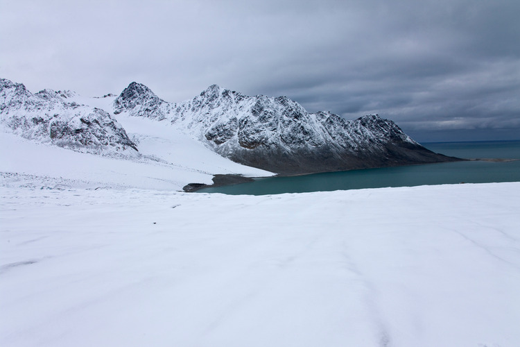
Arctic landscape: Image: Shutterstock
When were the world’s deserts formed?
During the most recent ice age, which began around 18,000 years ago and ended as the Holocene dawned some 6,300 years later, polar deserts were widespread. Yet as the earth warmed, deserts were not an immediate phenomenon. Around 11,000 years ago, the area where the Sahara Desert now resides was lush, green, and forested, abundant with bodies of water. Slight changes in the tilt of the earth’s axis affect the trajectory of the sun’s rays into the atmosphere, altering the fine climactic balance which produces the earth’s biomes.
Despite this explanation, there is a gap in the data that scientists have never been able to conclusively explain. The aridity of the Sahara came at an abnormal acceleration. Archaeologist David Wright’s research into the phenomenon posits that humans had a bearing on the change. With the advent of the domestication of livestock, humans grazed animals in the area, and, as Wright argues, this overgrazing led to a decline of plant life and the formation of a desert habitat. Nevertheless, the origins of our deserts remain somewhat shrouded in mystery.
Desertification
Deserts are getting bigger. Desertification is the process of land becoming desert and can happen for a variety of reasons, such as overgrazing of livestock and deforestation. Climate change, however, is a crucial factor. Areas close to deserts, such as the Sahel, located south of the Sahara, are particularly at risk. Global warming has led to desert regions becoming more extreme in their aridity and high temperatures, which makes exposed adjacent areas more susceptible to desertification. Various solutions have been posed and tested, such as the ‘Great Green Wall’ in the Sahel – an eight thousand kilometres long ‘wall’ of acacia trees.
The moisture stored in these trees and their roots prevents further desertification and provides a lively habitat for other flora and fauna, encouraging increased biodiversity and ecological richness. In the latest Geographical Podcast, see how communities in the Draa River Valley, Morocco, have defiantly resisted desertification and how indigenous knowledge is being used in ‘natural infrastructure’ to reverse the damaging process.
What can we learn from Indigenous desert communities?

Australian outback. Image: Shutterstock
Ten inches of rainfall a year is nowhere near enough to sustain most of the flora and fauna on earth, let alone a yearly crop. Nevertheless, deserts are habitats for many specialist plant and animal species, whilst also being home to one billion humans, who have adapted to their hostile surroundings in many ways. Historically, ancient settlements lived in Nevada and Arizona from 7000–8000BC to around 2000BC, who found food either by hunting small game or foraging for seeds.
Today, Dubai and Las Vegas are famous examples of cities which, through intense exploitation of natural resources and use of elaborate irrigation technology, have been able to defy one of nature’s most extreme and inhospitable climates.
In the UAE, the process of cloud seeding has been used to help existing clouds produce more rain. This typically involves aircraft dropping small particles, such as silver iodide, into clouds, which are then able to turn water vapour into rain more easily. Cloud seeding is also used across the world, such as in California to increase snowfall in the Sierra Nevada mountains.
Meanwhile, Indigenous communities have been adapting the desert environment to human needs, in more symbiotic ways, for thousands of years.
Australia’s aboriginal communities, for example, use long-established methods to coax water out of rock holes and roots, even in the desert. Beyond the displacement, prejudice, and erasure these communities have experienced, they are also affected disproportionately by climate change. Indigenous activists such as Paul Kabai, a Torres Strait Islander taking the Australian government to court over failing to prevent climate change, are at the helm of the fight against the climate crisis. Working together with these generationally knowledgeable communities, desertification can be prevented.
If you liked this article, check out our Where in the World desert quiz.