Discover the eight solutions helping to keep blazes at bay – from gas detectors to sky taxis and fire-retardant materials
By
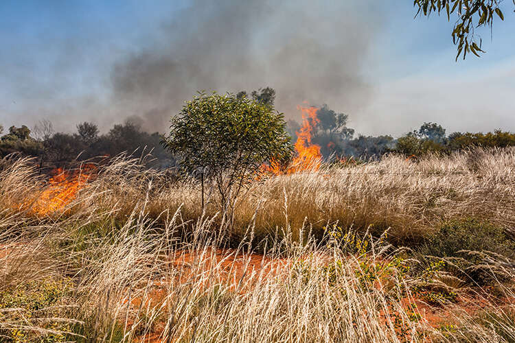
As wildfires ravaged through southeast Europe last week, the devastation that such blazes can bring is more obvious than ever. Today, forest fires burn more than twice as much tree cover each year as they did two decades ago. As well as this, wildfires pose serious risk to human health: estimates also calculate 1.5 million deaths each year are caused by smoke emitted by wildfires
With 2024 the worst year on record for wildfires – an area roughly the size of Greece entirely scorched – we look to the innovative solutions around the world helping to curb such blazes…
Enjoying this article? Check out our related reads:
Solar-powered gas detectors
First trialled in Germany, these wireless detectors are able to detect gas from smouldering fires. Once gas is present, the system automatically dispatches an AI drone to the scene to capture infrared and optical imagery, allowing emergency personnel to see the situation at hand as quickly as possible.
In turn, this allows precise coordinates to be shared with firefighters, along with live video to aid efforts to curb the fire.
Each gas sensor can protect an area the size of a football field and is attached to a tree.
AI sky taxis
Dubbed eTankers, researchers at UC Berkley’s Institute for Transportation Studies have created vertical take-off and landing sky taxis for the purpose of fighting wildfires. These pilotless, electric planes would be able to operate at night or in dense smoke, delivering up to 20 times more fire suppressant per hour than traditional manned tankers, and without emitting any carbon dioxide.
These futuristic vehicles would launch from airparks, operate silently using electric propulsion and use onboard thermal cameras to autonomously locate hotspots and execute precise drops of retardant and water.
AI-enabled cameras
Along with gas detectors, artificial intelligence can also support cameras to aid wildfire detection. California’s ALERTCalifornia system uses more than 1,100 AI-enabled cameras to detect small fires earlier in high-risk fire zones, such as mountainous terrain and urban-wildlife interfaces. The system is able to pan around regions every two minutes, scanning for traces of smoke.
In one example, a vegetation fire was confined to less than a quarter-acre thanks to the system.
Other examples of AI cameras can be found in Washington state, where 21 cameras are placed at high-risk zones and offer public live feeds, allowing residents to help spot wildfires in early development.
While such cameras are vital for responders to know where a fire is, curbing a fire still requires physical types of technology, such as aeroplanes dousing flames in water.
Fire-retardant materials
Researchers have developed a sprayable hydrogel – using cellulose-based polymers and silica – that changes properties under heat. Exposed to high temperatures, the gel transitions into a silica aerogel, forming a porous but insulating barrier that can continue to protect structures long after water has evaporated.
Tests on plywood exposed to a gas torch showed the most effective formulation prevented charring for more than 7 minutes, compared to under 90 seconds with conventional water gels.
Another innovation – a bio-based, marine hydrogel – adheres strongly to surfaces and forms char layers when dry. Completely non-toxic, it acts as an environmentally safe fire retardant barrier across vegetated zones to halt the spread of wildfires.
More research is being conducted in the area to create more materials that can either suppress flames, reduce smoke generation and provide better protection to infrastructure like homes in the event of a wildfire.
Google’s FireSat
While you might think efforts to curb wildfires need to stay on Earth, there is a new system helping out all the way from space. Google’s FireSat is a dedicated constellation of more than 50 low Earth orbit satellites, purpose-built to detect and monitor wildfires globally using AI-enhanced infrared imagery.
Once fully deployed, the system will be able to scan the planet every 20 minutes for the presence of wildfires. Currently, it is able to spot wildfires as small as five metres by five metres (the typical size of a bedroom), a resolution far smaller than the limits of other satellites.
In short, the system works by feeding imagery into AI models that compare each image to a baseline of previous ones, incorporating information such as weather forecasts, infrastructure data and terrain features in order to separate anomalies like industrial heat sources from genuine wildfires.
Machine learning forecasting models
Launched in April 2025, the European Centre for Medium-Range Weather Forecasts began to operate its Probability of Fire model, a software able to forecast wildfire activity using 19 different variables from vegetation dryness to fuel availability.
Compared to traditional models such as the Fire Weather Index, PoF is able to predict with accuracy up to 30 per cent higher, better pinpointing ignition hotspots such as those during the January 2025 Los Angeles fires.
Other models include FireCastNet – which uses networks to forecast at-risk areas up to six months in advance using global datasets include climate, vegetation and human factors – as well as SwinUnet which is able to forecast wildfire spread one day ahead.
Autonomous drone swarms
A British Columbia-based company is developing jet-powered drone swarms – capable of carrying around 350–400 kilograms of flame retardant or water – that will bridge the gaps where manned aircraft cannot operate, such as at night or in dense smoke.
The autonomous system will use AI-driven algorithms to target hotspots, even in conditions where traditional aircraft would be grounded.
The project – dubbed FireSwarm – has received extensive funding, allowing it to accelerate its development and even begin trialling field pilots.
Elsewhere, in Bristol, other companies are also trialling out swarms of drones to aid with wildfires. Each of these drones is able to carry up to 100 kilograms of fire retardant. Like flocks of birds or insect colonies, these drones are able to autonomously coordinate to detect and suppress fires in their early stages.
AI detection of power line faults
When power lines touch materials such as tree branches, vegetation or dry soil, heat can potentially be generated and consequently ignite nearby vegetation. Such faults typically go undetected by traditional wildfire mitigation efforts, yet they pose a serious wildfire risk.
However, scientists have developed an AI system to accurately detect and isolate these faults directly at the site. In lab and pilot tests, the system achieved detection and stabilisation of such faults at more than 90 per cent accuracy.
Now, more tests are being conducted around multiple North American locations.