The demise of Britain’s last ice sheet holds clues to future sea-level rise, geographer Geraint Jenkins explains to Bryony Cottam
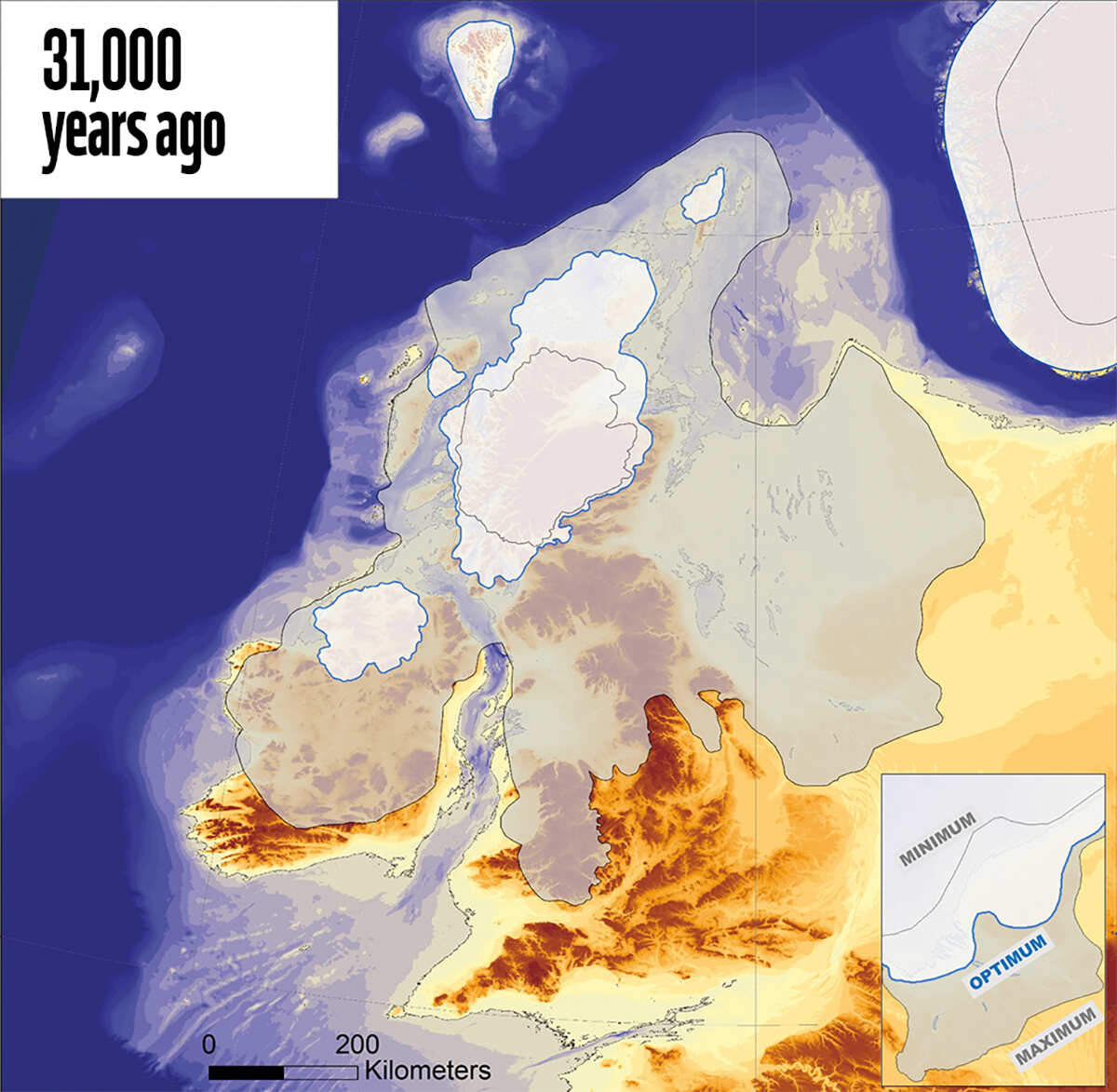
Around 31,000 years ago, a giant ice sheet began its advance across the British Isles. The Isle of Man lay directly in its path. As ice spread south from the Scottish Highlands towards Ireland and southwards through the Irish Sea, the isle was completely submerged, its landscape carved by glacial flow. When the Earth’s temperatures warmed again, the ice retreated, leaving behind sand and other sediments, including pebbles dragged from the Scottish mountains and the depths of the Irish Sea.
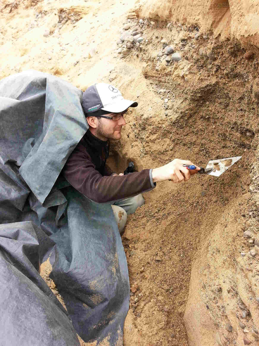
‘About 70 per cent of the entire UK was covered in ice at one point,’ says Geraint Jenkins, a doctor and researcher of paleo-environmental change at Coventry University. ‘It stretched from the Scilly Isles all the way up to northern Scotland.’ As such, glacial sediment is found in abundance across the country. ‘The majority of UK roads are made up of sand and gravel extracted from these glacial deposits,’ says Jenkins, who found himself on the exposed cliffs of Orrisdale Head, on the Isle of Man’s northwest coast, digging up sediment for a very different reason. He was looking for evidence that could help date the ice sheet’s ebb and flow.

Back at the Aberystwyth Luminescence Laboratory, under the subdued red glow of low-energy-emitting lamps, ten granite cobbles excavated from the headland were cored and sliced into small cylinders of rock. When Jenkins and his colleagues shone a light on these samples, it triggered the release of energy that had long been trapped within them; the light that shone back had been stored for more than 20,000 years.
Unlike radiocarbon dating (often simply known as ‘carbon dating’), luminescence dating is a relatively little-known method used for determining an object’s age. Used extensively in archaeology and the earth sciences, it allows scientists to determine when an object was last exposed to sunlight or heat. ‘It could be a piece of Roman stoneware dropped in the Earth,’ says Jenkins, ‘or it could be a grain of sand buried in a landslide or glacial deposit. While buried, it’s exposed to naturally occurring radioactive decay in the soil and sediment around it, usually from uranium, thorium and potassium. Some of the energy delivered by that radiation gets trapped in the mineral grains and is stored away.’
Any energy that accumulates is released if the object is exposed to enough heat or sunlight – while that sand grain is carried along by a glacial stream, for example. Once in the ground again, energy starts to build back up. Jenkins describes these grains as dosimeters: ‘They record the amount of radiation they are exposed to while they are buried; generally speaking, the longer they’re buried, the more they store up.’ Jenkins reveals an image of a rock slice that is glowing in the dark. ‘That’s the very energy that’s been stored in the mineral grains for 21,000 years,’ he says. ‘When we shine a light on it, it’s released as light itself.’
Luminescence dating surpasses the limits of radiocarbon dating (carbon-14 decays over time) by several hundred thousand years, which is what makes it so useful for understanding early human history. It has helped establish timelines for human migration to Asia and revealed the role of drought in the decline of the ancient Indus Valley Civilisation. It plays an important part in reconstructing Earth’s geological history, too.
When the BRITICE glacial mapping project published a detailed reconstruction of the growth and decay of the British-Irish ice sheet in November last year, it pulled in data from researchers working on radiocarbon, cosmogenic and luminescence dating across hundreds of locations; the latter proved essential to providing 156 dates for key stages in the evolution of the ice sheet.


While luminescence dating generates a lot of data, often at a lower cost than other methods, it does have its challenges. ‘Generally, glacial environments are quite cold, and there’s not much sunlight, so the material isn’t always bleached,’ Jenkins says. ‘That can give you challenges with interpreting ages later on down the line.’ But he and his colleagues found that looking at cobble cores, rather than tiny grains, revealed just how far the light had penetrated into the subsurface of the rock as it sat in a riverbed and how long it had sat there. One well-bleached cobble even showed evidence of two bleaching events, possibly from both the advance and retreat of the British-Irish ice sheet.
Combining all this data, the BRITICE mapped the ice sheet for each millennium. At its maximum extent, 24,000 years ago, the ice sheet was discovered to be about 30 per cent larger than was previously thought. Knowing that, the researchers were able to calculate that once all of the ice had melted, it would have led to 1.8 metres of global sea level rise.
‘That gives us a good picture of how much sea levels could rise from the melting of the Greenland ice sheet,’ says Jenkins. ‘We know that the British-Irish ice sheet was about a quarter of its size.’ He adds that, in some areas, the ice sheet’s retreat was faster than others for reasons other than climate, such as the shape of the ocean floor. ‘How do we know how the ice sheets of Greenland and Antarctica are going to respond in the future? We use the measurements from this ice sheet.’ Without them, there’s no way to test current predictions.


