2011 Japan Tohoku Earthquake led to tsunami that caused nuclear accident and widespread destruction, killing over 18,000 people
by Victoria Heath
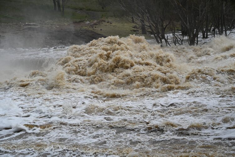
On March 11, 2011, the 9.1-magnitude Tohoku Earthquake hit off the northeast coast of Honshu on the Japan Trench. Also known as the Great Sendai Earthquake or Great East Japan Earthquake, it was the strongest-ever earthquake recorded in Japan. The subsequent tsunami generated by the main shock of the earthquake affected a 2000-kilometre of coast, causing widespread damage and the melting of three nuclear cores of the Fukushima Daiichi reactors in a significant nuclear accident.
Aftermath of 2011 Tohoku Earthquake and tsunami
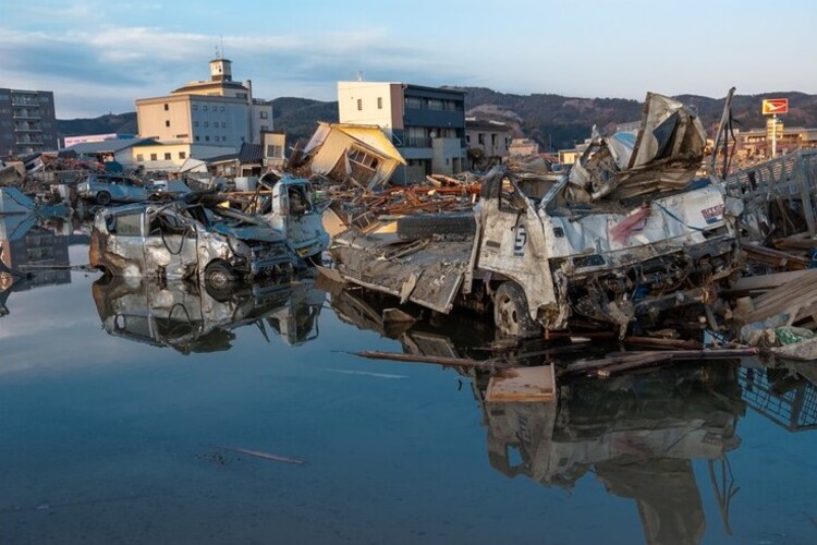
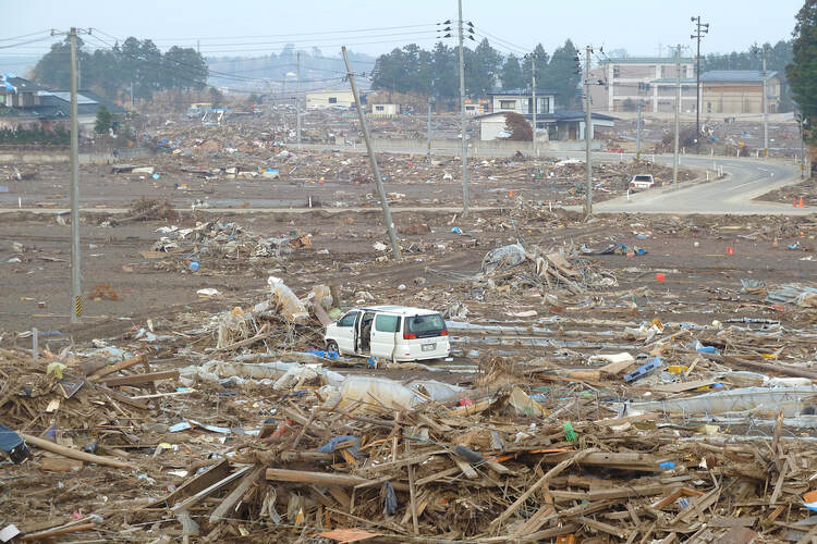
The natural disaster killed over 18,000 people, including several thousand who were never recovered. The majority of casualties and damage occurred in Iwate, Miyagi and Fukushima from the tsunami.
Buildings were devastated with nearly 400,000 destroyed or irreparably damaged, and 750,000 partially destroyed after the earthquake and tsunami. According to the U.S Geological Survey, the earthquake moved the main island of Honshu eastward by 8 feet (2.4 metres), and dropped about 250 miles (400 kilometres) of coastline by 2 feet (0.6 metres).
Tsunami waves that were generated from the earthquake damaged backup generators at the Fukushima Daiichi plant, causing the second-worst nuclear accident in the history of nuclear power generation. Chemical explosions in the plant caused radioactive material to leak into the atmosphere and Pacific Ocean.
More than 150,000 people were forced to evacuate the area, and at least 16 workers were injured in the explosions and dozens exposed to radiation while they attempted to stabilise the plant.
According to The World Bank, the 2011 Tohoku earthquake and tsunami is estimated to be the most expensive natural disaster in world history, with estimates that Japan has spent nearly $300 billion USD in rebuilding. 98% of the damage from the event was caused by the tsunami alone.
Outside of Japan, one person was killed and several houses destroyed in Jayapura, Indonesia by a tsunami. Another person was killed south of Crescent City, California, with several boats and docks destroyed by a tsunami with a recorded height of over 8ft.
Damage was also reported in Chile, French Polynesia, Galapagos Islands and Peru.
What caused the earthquake and tsunami?
According to the U.S Geological Survey, the earthquake was caused by shallow thrust faulting on the subduction zone plate boundary between the Pacific and North America plate.
The region has a high rate of seismic activity, with past earthquakes in the region generating deadly tsunamis. Large offshore earthquakes were recorded in the same subduction zone in 1611, 1896, and 1933.

Measures implemented since 2011 Tohoku Earthquake
Japan already had adopted The Pacific Tsunami Warning System in 1965, following the loss of several thousands of lives across the world to large, far-afield tsunamis. But the 2011 Tohoku Earthquake and tsunami allowed Japan to further identify larger lessons for disaster risk management.
Three years after the natural disaster, The World Bank published a report, Learning from Megadisasters: Lessons from the Great East Japan Earthquake, in which key lessons could be drawn from the event. These included countries taking a holistic, as opposed to single-sector approach to disaster risk management (DRM); and highlighting that effective DRM requires diverse stakeholders, including ‘various levels of government, community and nonprofit actors, and the private sector’.
Additionally, researchers collected data on tsunami wave forces and building performance, leading to improvement in tsunami mitigation strategies.