Scientists think a long extinct river might be the key to solving the mystery behind how the pyramids were constructed.
By
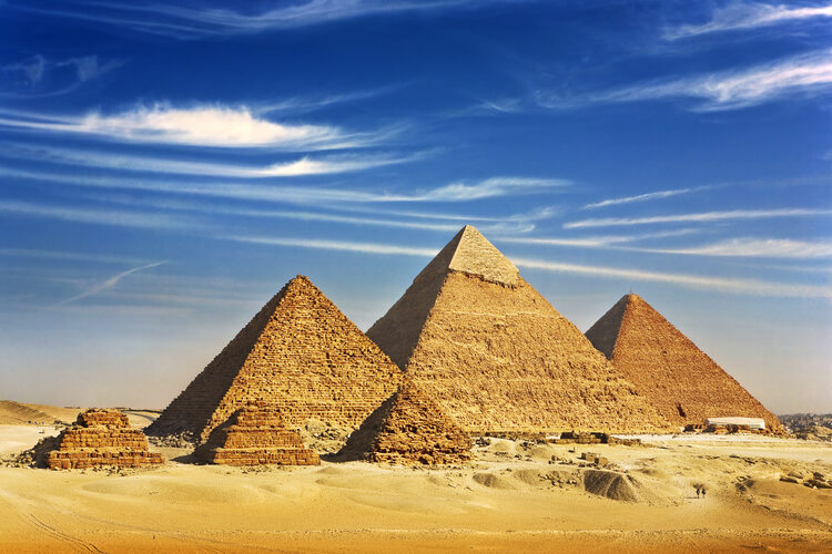
Of the ancient Seven Wonders of the World, they are the only ones left standing. And, for the 4,500 years since they were built, they’ve constantly tormented us. How is it possible that objects so perfect – and giant – could have been built with the technology of the time? We are of course talking about Egypt’s Great Pyramids of Giza.
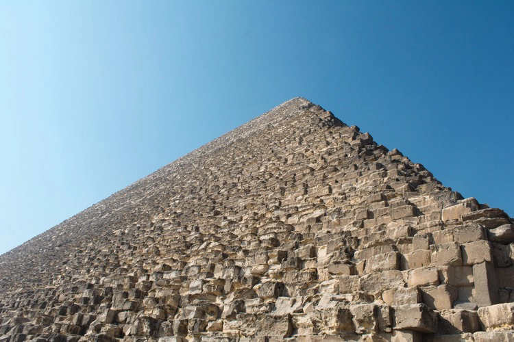
Built to last for all eternity by the pharaohs of Egypt’s Old Kingdom, the three pyramids of Giza are the monumental tombs for the pharaohs Khufu, Khafre and Menkaure. The largest of the pyramids, which was built for Khufu in the early 25th century BCE, originally stood 147m tall. Thanks to erosion and the loss of the polished limestone casing stones that once covered it, it’s today about 10m lower. Each of its four sides is 230m long, and its construction required the use of around 2.3 million blocks of stone to create a final structure weighing in at 5.75 million tonnes. Each of these blocks needed to be cut and then transported and assembled and the whole lot has been built to be perfectly aligned with the cardinal points of the compass. Even today, with all our technology, building the pyramids would be a monumental task.
This has led generations of archaeologists, engineers and others to ponder how the enormous amount of rock required for the construction of the pyramids was transported to the site. Over the centuries, all sorts of theories have been put forward. These range from teams of slaves, thousands strong, pulling the rocks into place (in recent years, it’s been determined that slaves were not used but a well-paid workforce) to the whole lot being built by alien life forms.
Now, though, a team of scientists from the University of North Carolina Wilmington, writing in the journal Nature, believe they might have cracked the mystery about how the rock was transported to the site. The presence of a long since dried up waterway, along which the rock was transported on large rafts, has long been suspected but nobody had any solid evidence showing that such a river had ever existed. However, by using a combination of radar satellite imagery, historical maps, geophysical surveys, and sediment coring (which is commonly used by archaeologists to recover evidence from samples) the team discovered that a branch of the River Nile did indeed once flow right past the Great Pyramids of Giza, as well as over thirty other lesser pyramids.
As well as the river itself, the team also discovered buried ancient structures running along the foothills close to many of the pyramids. It is hoped that this new discovery will help researchers to understand where ancient settlements were located, prioritising these sites for fieldwork investigation and prevent them from being lost to rapid urbanisation.
The river branch itself is estimated to have been 64km long and 200-700m wide. In the past this waterway would have played a pivotal role in connecting important locations in ancient Egypt – including cities and towns. This river, the team suspects, was the key that allowed the pharaohs to get all the rock and other building material and equipment into place to build the pyramids.
So, what happened to this river branch? The answer to that is likely to be climate change. Around 12,000 years ago, rainfall was much higher in the area we now know as the Sahara Desert. Instead of giant sand seas, there were rolling grasslands and woodlands, while the Nile valley itself was swampy, and the Nile had multiple branches. Slowly, over thousands of years, the climate in North Africa has turned ever more arid (a process that is still continuing today), but when the pyramids were built, the waters in the Nile, though much reduced, were still notably higher than today and other river branches still existed. One of those was the one used by the builders of the pyramids, but since then, the river has totally dried up, and – until now – its very existence was buried under the desert sands.
Related articles: