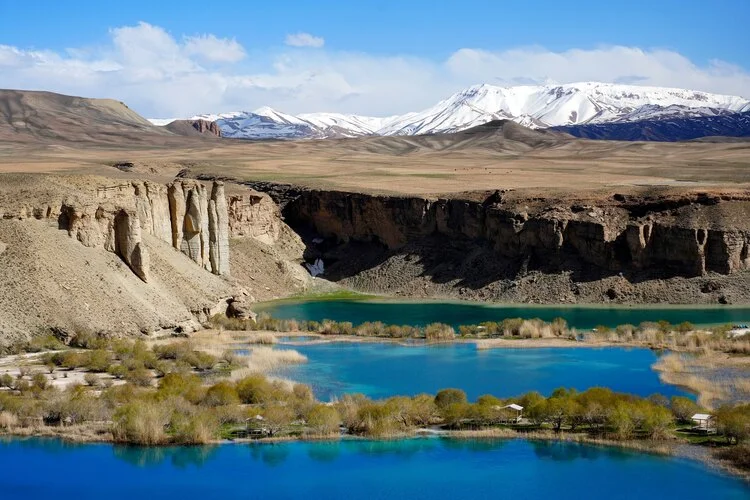
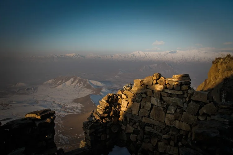
Afghanistan is the world’s second-most prone country to natural disasters. Discover which natural hazards it is threatened by and why
For every one million inhabitants in Afghanistan, 1,150 people die each yeart. Of these deaths, 50 per cent are caused by national disasters. Only one other country – Haiti – surpasses Afghanistan in the number of fatalities caused in this way.
As well as deaths, natural disasters in the country have led to millions of dollars worth of damage and exacerbated poverty – with those in vulnerable communities suffering the shocks of natural disasters twice as severely as those in wealthier areas.
Find out below the various natural disasters that Afghanistan is prone to and the measures being taken to mitigate their effects:
Flooding
Flooding is Afghanistan’s most common natural hazard, with over 100,000 people affected each year. By 2050, this is estimated to more than double due to the added effects of climate change and socioeconomic growth. The most flood-affected regions in Afghanistan are the province of Kabul, as well as Hairatan in the north of the country and the Helmand Basin in the west.
The sources of most of the country’s rivers is from the glaciers and snow in mountains, but when this rapidly melts, flooding can occur. Heavy rainfall also forms a factor for river flooding, combined with the steep slopes in headwaters.
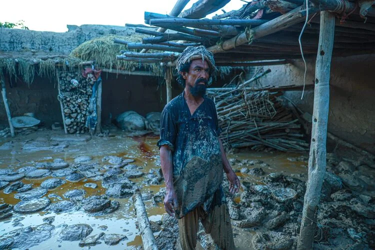
Just this summer, heavy flooding killed 40 people in eastern Afghanistan, injured at least 350 and left 1,500 children without homes. Infrastrucuture damage was also reported in the affected districts of Nangarhar, Kunar and Laghman.
Two months prior to these floods – in May 2024 – storms hit the northeastern part of the country, particularly in the provinces of Baghlan and Badakhshan. The floods which followed killed nearly 350 people, left 7,800 homes damaged or destroyed and displaced 5,000 families. Some of the affected areas experienced drought last year, highlighting how climate change is a factor contributing to Afghanistan’s worsening natural disasters.
Projects such as flood retaining walls are being proposed as measures to tackle flooding in Afghanistan. A single new embankment in Kabul could reduce flood damages by $600,000 per year, while flood retaining walls in the province would cost just $180,000 but provide a net value of $13.5 million.
Earthquakes
Afghanistan is located in a tectonically-active part of the world, on the edge of the Eurasian tectonic plate. It is bordered by the northern boundary of the Indian plate and with the Arabian plate into the south.
Earthquakes cause the most fatalities in Afghanistan – with almost 2.7 million deaths recorded from the natural disasters since 1900 – and can often lead to landslides in more mountainous regions.
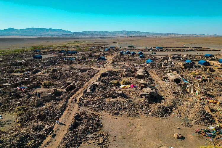
In October 2023, three earthquakes hit Afghanistan in the space of just eight days, all ranging between 6.3 and 6.4-magnitude in the Herat, Badghis and Farah provinces. Nearly 1,500 people were killed in Herat and the surrounding districts. In the three most affected areas, almost 150,000 people lost their homes, or faced severe damage to them.
The quakes also caused entire villages to be flattened, and six schools were destroyed alongside two community education centres in the affected areas.
Plans to strengthen the country’s defences against earthquakes include retrofitting existing buildings to prevent building collapse. In particular, ensuring schools have adequate infrastructure would reduce potential economic losses by 60 per cent, and reduce fatalities by 90 per cent.
Droughts
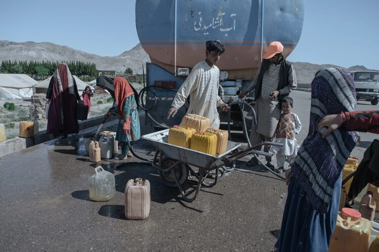
With more than 85 per cent of Afghanistan’s population reliant on agriculture for their livelihood, droughts have a significant and far-reaching impact in the country. On average, droughts cause $280 million in economic damages each year, and can severely impact food security for millions if prolonged enough.
The risk of drought is highest in the Helmand basin, and lowest in the northeast, but is overall expected to increase in the future due to a lack of rainfall caused by climate change. Effective water management could reduce water shortages during droughts, as well as creating canals and irrigation systems for the agricultural sector.
In February 2024, Afghanistan experienced its worst drought in 30 years, after experiencing a lack of snow in the country over the winter period. Almost 75 per cent of all provinces – more than half of the country’s population of 40 million – suffered either severe or catastrophic drought conditions.
Landslides
More than 60 per cent of Afghanistan’s terrain is mountainous, meaning that landslides are common. They are often caused by earthquake shaking and heavy rainfall, which are both again frequent within the country due to the presence of other natural disasters like flooding and earthquakes.
Due to population growth, it is estimated that the number of people affected by landslides in Afghanistan could double by 2050.
In 2014, a hillside which was saturated with heavy rainfall collapsed on the village of Ab Barak in northeastern Afghanistan. The natural disaster led to an estimated death toll of between 350–2000.
In February 2024, a landslide killed at least 25 people after heavy snowfall in the eastern village of Nuristan, with between 15–20 homes either completely or partially destroyed, according to a spokesman for Afghanistan’s disaster management ministry, Janan Sayeq.
Methods to help counter the risk of landslides include reinforcing local monitoring of high-risk slopes, creating boulder-gathering trenches at hillsides, and avoiding the construction of buildings and transport networks in high landslide hazard areas.
Avalanches

Avalanches of snow are most common in the Hindu Kash mountainous regions of Afghanistan in the northeast and western areas, particularly in Badakhshan, Kabul, and Daykundi.
In some lower-lying areas, climate change may decrease the risk of avalanches. On the flip side, higher altitude areas – such as the Salang Pass – may be more prone to avalanches in mid-winter due to increased snowfall.
The 2015 Afghanistan avalanches – hitting four northeast provinces of the country – killed at least 229 people, burying entire homes underneath snow.
Creating retention structures like snow drift fences, avalanche dams, avalanche galleries and snow supporting structures, can help to reduce avalanche risk. As well as this, reinforcing buildings in these areas could prevent natural disasters.