These vast, swirling conveyor belts are key to many of our planet’s processes – take a look at how vital ocean currents are
By
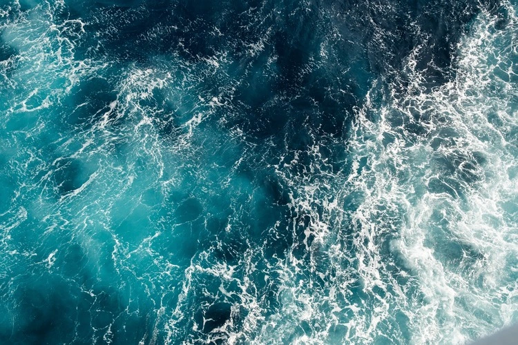
Covering 71 per cent of the planet – and holding 97 per cent of its water – the ocean plays a major role in storing and transferring heat energy across the globe. When this heat moves, it does so via ocean currents, and it is this process that can affect temperature, weather conditions, climate patterns and nutrient access to marine life.
Ocean currents are expansive, spanning from the circumference of the Antarctic to the warm waters of California. To put their size into perspective, it would take 1,000 years for a single water molecule to travel through the entire system of the world’s ocean currents – the ‘global conveyor belt’ as it is so aptly dubbed.
Enjoying this article? Check out some of our related reads…
Here we take a deep dive into the world of ocean currents, their formation and some of the most notable ones:
How do ocean currents form?
Ocean currents are formed due to three key factors: the rise and fall of tides, wind and thermohaline circulation – a process caused by density differences in water depending on its temperature (thermo) and salt (haline) content.
Surface level currents – those occurring on the ocean’s surface (up to a maximum depth of 100m) – are mostly controlled by tides and wind. Tides create currents –known as tidal currents – that are stronger near shores, bays and estuaries. Their changes are mostly regular and can be predicted.
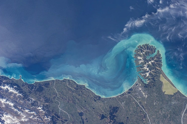
Winds also drive currents near the ocean’s surface, with coastal upwelling – the process of bringing cold and nutrient-rich water to the surface – occurring due to small-scale coastal area winds. Upwelling is a crucial process that means phytoplankton and seaweed can grow, which in turn supports larger marine life.
Wind also plays a huge role in driving ocean currents for thousands of miles in oceans across the world.
The final way that an ocean current can form is through thermohaline circulation. An example of this is the Gulf Stream.
Currents formed in this way occur at both deep and shallow levels, and move much more slowly than tidal and surface currents. These currents move vertically – up and down the water column – compared to the side-to-side horizontal movements of surface-level currents.
After they have formed, ocean currents move in a rocky and non-linear path. Due to the planet’s rotation, ocean waters are unable to move in a straight path as they travel. This means that ocean currents in the Northern Hemisphere veer to the right, while in the Southern Hemisphere they veer to the left.
Mapping the ocean’s currents
The vast expanse of currents around the world was first mapped by Matthew Fontaine Maury in the mid to late 1800s. By using data of daily locations, speeds and directions of winds compiled from logbooks that sea captains made, Maury discovered patterns to eventually produce ocean current and wind charts.
Part of the early observations of ocean currents also included messages in bottles. Maury would ask sailors to drop these into the ocean, with a message stating when the bottle was thrown overboard. When they were found by people, Maury could then determine more detailed ocean current patterns.
Today, more modern technology can be deployed to chart the Earth’s currents. Using radio antennas and high-frequency radar instruments, scientists can measure surface velocity for thousands of points, translating this data into a ‘map’ for a large area.
The Gulf Stream

One of the world’s most important ocean currents in the Gulf Stream, which carries a staggering 150 times more water than the Amazon River. The current originates in the Caribbean, then moves to the US East Coast and across the Atlantic Ocean toward Europe. The heat it carries keeps much of Northern Europe warmer than other places as far north.
Without the Gulf Stream, the climate would be much cooler and drier in Europe.
Studying the Gulf Stream is a difficult feat for scientists since it is made up of a complex network of ocean currents which shift, disappear and change over time. The ability to monitor the current has come a long way since it was first charted in the early 1770s by Benjamin Franklin.
Think you know your oceans? Score high enough in our quiz & win a prize:
The Antarctic Circumpolar Current
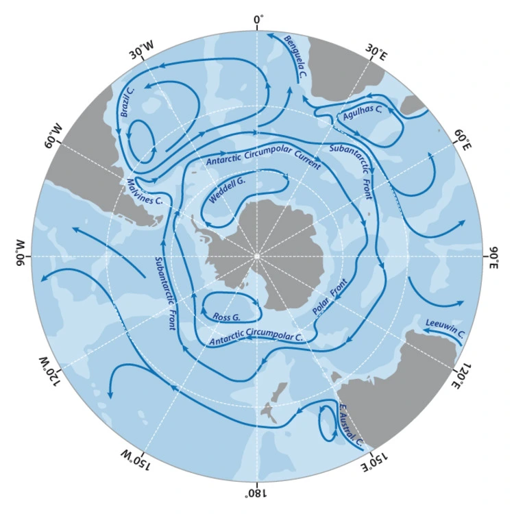
The Antarctic Circumpolar Current (also known as the ACC) is the largest and strongest ocean current in the world, circling Antarctica and flowing from west to east.
The ocean current is created by both strong westerly winds across the Southern Ocean and the significant change in surface temperatures between the poles and the Equator.
It links the main basins of the world’s oceans – the Atlantic, Indian and Pacific – together. The Antarctic Circumpolar Current carries an estimated 165 million to 182 million cubic metres of water per second, and can reach both abyss-level water depths and shallower water to help circulate heat and nutrients between basins.
Its most important role, as its name suggests, is regulating Antarctica’s temperature and keeping the continent icy. It maintains the boundary between the warm waters northward of Antarctica and the freezing-cold waters that surround the continent.
The Kuroshio Current
Translating to ‘Black Current’ for its darker colour compared to the sea it flows through, the Kuroshio Current is a strong surface oceanic current found in the Pacific Ocean, first mapped by in 1650 by Bernhardus Varenius.
It is the biggest current in the western Pacific and begins off the coast of the Philipines and stretches to Japan’s east coast, carrying 50 million tonnes of warm subtropical water – an equivalent volume to 6,000 large rivers – per second.
Despite the lack of nutrients at the very surface, fish species still migrate to the site for spawning and migration purposes. This contradiction is aptly coined the ‘Kuroshio Paradox’. Recent research has sought to understand this paradox, discovering that these fish may be drawn to the waters through large nutrient quantities in dark sub-surface layers instead.
Heat, which the Kuroshio Current transports, can cause cloud formations and change the pattern of storms. As well as affecting weather, the current is also vital for the fishing industry due to the diverse and rich range of species – from lobsters to turban shell – found there.
Along with the Gulf Stream Extension, the Kuroshio Current Extension – the area downstream of the Kuroshio east of Honshu Island in Japan – is one of the world’s biggest net carbon dioxide sinks.
Although research is still being conducted to understanding why, scientists point toward the process of water cooling from south to north – which increases the ability to uptake CO2 – as well as phytoplankton photosynthesis.
Are ocean currents affected by climate change?
The short answer: yes. Ocean currents are affected by rising temperatures due to climate change, which can cause impacts from evaporating seawater to glacial and sea ice melts. In turn, this means warm freshwater can sit on the ocean surface, decreasing the quantity of sea ice produced and letting dense, salty and cold water to sink further below the surface.
It is this that could slow or even stop the ocean conveyor belt, which would result in global effects including drastic decreases in Europe’s temperatures if the Gulf Stream were affected severely enough.
A study in 2024 found that the Gulf Stream may be particularly sensitive to future climate change. Researchers from UCL concluded that during the last ice age around 20,000 years ago – the Gulf Stream was stronger due to more powerful winds across subtropical North Atlantic. With research pointing to a likelihood of subtropical winds decreasing due to climate change, the Gulf Stream could weaken along with it, although the size of this effect is not yet fully understood.
Like the Gulf Stream, the Antarctic Circumpolar Current has faced repercussions from climate change. Since 1955, the upper ocean temperatures to the west of the Antarctic Peninsula have increased by more than 1C, and it is now known that the ACC is warming more rapidly than the entirety of the global ocean.


