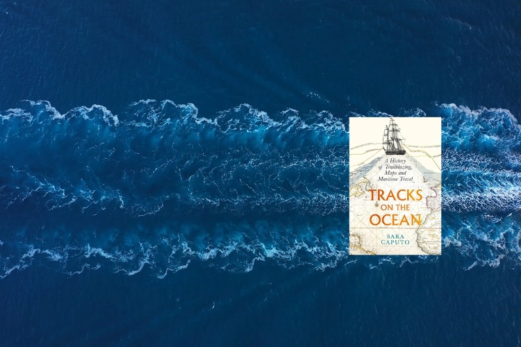
From colonisation to migration, Sara Caputo’s latest book offers an insight into how humans use seas to shape the world
By
What does a track tell us? On land, routes get modernised, expanded, clogged up, closed but they are at least tangible and generally fixed by physical infrastructure. Travellers by and large stick to them. Sea routes are, self-evidently, rather more fluid. Most likely, any track you see of a pre-digital-era ocean voyage is inaccurate: it may show the departure point, the broad route travelled and the destination but the fine detail – where the ship went, why it changed tack, went slower, faster – will be absent. At best, we can get only a rough idea of those minutiae. So why do we depict ocean journeys as lines?
More insights may be gained were we to look at these routes from another angle, suggests author Sara Caputo, a specialist in maritime and 18th- and 19th-century history at Magdalene College, Cambridge. Journey first, map second. By looking at the personal, rather than literal, trails we glean knowledge as to how humans have used the seas to shape the world, from colonisation to migration – and how we continue to do so in the form of exhaust fumes belched out by super-sized tankers and ocean liners.
No matter that no true, precise map exists of Ferdinand Magellan’s route to the Pacific – what’s more important is how it embodied the spirit of adventure. Later, the scientific charts of the Royal Navy constructed a framework for conquests and settlement. ‘All maps are subjective and statements of power… All maps lie and fabricate,’ warns Caputo.

And so the theme of this book is less the route per se, more the ‘why’: why the route was taken, the motive, where it went, the impacts it had on the people who made the journey and on those they encountered.
The conceit is a nuanced one that the author does not, in all honesty, successfully explain. Perhaps there’s an analogy with the flight path of an aircraft – the kink in the route may reflect a diversion to avoid turbulence; and why did the aircraft choose the route it did? What demand drove the need for it? Or, given this book’s theme is maritime, we could compare the notion with that of footprints on the beach. Who made them? Why did they walk there and what made their tracks meander?
Beginning with voyages into true Terra Incognita, a trackless world depicted by a round map of the Homeric Mediterranean, the author travels through time and themes. In ancient, classical days, ‘maps’ as we might recognise them today were more likely to be periploi, which in Greek literally means ‘sailings around’. These written itineraries were more enlightening and of greater practical use than any attempt to ink a route on parchment, for they tell of the coloured cloth, the precious stones that were traded. They give us the why, the purpose of the journeys. They also give us more of an idea of where the ships actually went (generally, this was never out of sight of the shore).

Caputo does a fine job in conveying the pioneering, fearless spirit of those early journeys, made into the unknown, a time when many seafarers, setting sail into the blank seas of Renaissance maps, were genuinely apprehensive at the prospect of being gobbled up by sea monsters or falling off the edge of the world. ‘Sanitized lines don’t capture the deep feeling and lived observation,’ she writes. That much is true. The book is full of extraordinary detail, such as that of the Blackbraes, a three-masted sailing vessel that travelled from Newcastle to San Francisco in 1899, a journey that took ‘10 days short of a year’ mainly on account of it writhing around Cape Horn, a journey reconstructed day by painstaking day from a chart made by a boy on board, but that’s tangled by the sea almost beyond legibility.
And yet. As a fresh way of looking at the heavily studied, if eternally fascinating, combined subject of maps and maritime travel, the author doesn’t quite pull things off. The writing can be turgid and as dry as a ship’s biscuit from one of those early voyages to the New World. Throughout the book, we’re informed ‘here we shall consider’; ‘here we get a clue as to what…’; ‘we will return to these connotations later…’ At times it feels as though you are reading a doctorate paper – there is nothing wrong in principle with that, for this is a brainy book that most certainly doesn’t lack detail or expert knowledge – but too often the lack of pace, its tone of gravitas, deny the book the bounce that’s arguably required to draw in a lay audience.
The book is at its best when read as a vehicle for learning more about the seafarers of lore and more contemporary deployment of navigational charts. Larger than life personalities come to the surface, such as Admiral Hugh Clodberry Christian, who, in 1795, was thoroughly defeated not by the French navy he was seeking to fight in the Caribbean but by the storms that kept blowing him back to Portsmouth for 47 days before he gave up. The track chart of his misadventures, writes Caputo, is ‘a tangle of desperate zig-zags’.
If you can stick with the at times academically formal writing, you will come away with a reinvigorated respect for anyone who embarks on a sea voyage. They all have a tale to tell and it’s generally an intensely human one. The line of a map is just the entry point – it’s the colouring in that is really informative, revealing the complexities of human exploration.


