With the Bahamas still reeling from the shock of Hurricane Dorian, a new study highlights the potential of nature-based protection to minimise future damage
By Abigail Spink
Hundreds of people are reportedly still missing after Hurricane Dorian swept across the northernmost islands of the Bahamas – Grand Bahama and Abaco – just over a month ago. Storm surges and high winds wiped out the majority of infrastructure, contaminated water supplies and cut off electricity, rendering many parts of the country’s most populated islands uninhabitable.
Although Bahamians are used to battling extreme weather, often experiencing a highly active hurricane season, prime minister Hubert Minnis stated last week that Dorian was a clear indication of the ever-growing threat the climate crisis poses to low-lying coastal communities. He claimed that the Bahamas is facing ‘one of the greatest national crises in our country’s history.’

While recovery is set to be a long process for the worst affected areas, the government is urging tourists to visit those islands that remain unscathed. Minnis said in a speech to the UN’s General Assembly: ‘Please come and visit one or more of the 14 other major islands in the Bahamas not affected by Hurricane Dorian, including Nassau on the island of New Providence. The revenue from tourists visiting the Bahamas will play a vital role in reconstructing and rebuilding the affected areas.’
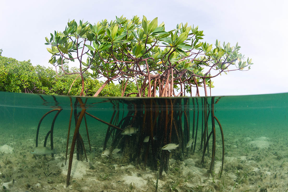
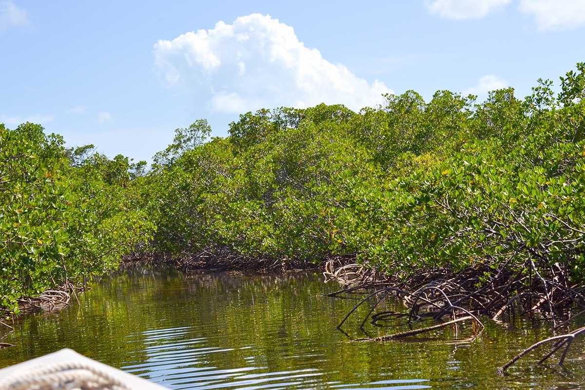
As well as encouraging tourism to the islands, implementing sustainable coastal resilience strategies in the most vulnerable areas is high on the agenda of regeneration efforts. A timely study released by Stanford University researchers highlights the vital ability of coastal habitats, such as coral and oyster reefs, seagrass beds, marshes, mangroves and coastal forests to dissipate wave energy and defend coastlines against flooding and storm surges. Crucially, it is encouraging the country to rethink its approach to hazard resilience in the face of increasing storm intensity and frequency.

Katie Arkema, lead scientist at Stanford’s natural capital project and author on the study, explained that traditional coastal defences are no longer sustainable in much of the region, due to costly upkeep and their inability to cope with worsening climatic conditions. ‘Hard shoreline defences such as seawalls, groins and breakwaters, require continual investment and maintenance because they are static – they can’t change and “adapt” as conditions around them change,’ she explains. ‘Natural ecosystems, on the other hand, are growing and altering based on changes in surrounding conditions. For example, as sea-levels rise, mangroves can secure more and more sediment in their roots to essentially help raise the height of the shoreline to keep pace with sea-level rise. This process is called accretion.’
The researchers used a coastal vulnerability model to identify where people are most at risk from coastal hazards, how sea-level rise will enhance risk and where marine ecosystems are already providing protection, in order to inform several planning efforts. It was found that coastal ecosystems currently provide protection for nearly 15 per cent of Bahamians, who will be at the highest risk of exposure to coastal hazards if habitats are lost. Modelled sea level rise indicates an increase in exposure across every island, but results show that the presence of coastal habitats could reduce this by up to two-thirds.
Most shockingly perhaps, it is revealed that if habitats are lost along >300km of coastline in Grand Bahama, where they already act as a natural buffer, nearly the entire island would be critically exposed.
The study has produced a number of notable outcomes, including assisting the development of a Climate-Resilient Coastal Management and Infrastructure Program financed by a $35million loan from the Inter-American Development Bank. As one of many pilot programs taking place across various islands, mangrove restoration will be evaluated as a natural method of coastal protection on the island of Andros. The risk assessment carried out may also be used to inform the placement of water mains, electrical lines, and other infrastructure in a way that would minimise future damage potential in less studied regions of the country.

Arkema explains that investing in and protecting these sites goes hand-in-hand with leveraging self-sufficiency, benefitting communities at large. ‘Even during the longer-term recovery, islands that have healthy coastal ecosystems may be able to get back on their feet faster as tourists are drawn to reefs and beautiful beaches for vacationing. Without those ecosystems, island communities will not have abundant fisheries nor the beautiful environment that attracts visitors,’ she claims.
Enhancing the knowledge base of local communities also emerged as a significant result of the project. Arkema concludes that: ‘Our results highlighted that the leeward sides of islands, where the water is shallow, are often more at risk to flooding from storm surges. This was very surprising to community members after Hurricane Matthew who thought the shallow water meant they were safe. We can use new technologies such as satellite imagery and coastal hazard models and engage with communities to enhance their understanding of risk factors.’
Even with a population mostly living less than ten metres above sea-level, the future doesn’t look totally bleak for the Bahamas. Now, it’s a case of maximising the potential of all resources available to allow for the best chances against climatic uncertainty and, increasingly, volatility.


