Do you know your cumulus from your nimbostratus? Discover the different types of clouds and how to tell them apart
By
Floating high above us, it can be easy to give clouds no more than a second glance. But these vast formations of water vapour and ice particles are as varied as the landscapes they appear in.
There are many ways that clouds can be categorised, but in general, most clouds are defined by the height of the cloud base above the Earth’s surface, harking back to a classification scheme published in the 19th century that is still used today.
This forms three main groups: those found at ‘high-level’ (above altitudes of 20,000 feet), clouds at ‘mid-level’ (between 6,500 and 20,000 feet) and finally, at ‘low-level’ (from the surface to 6,500 feet).
Enjoying this article? Check out these related reads:
Within these categories lie various sub-divisions depending on the cloud’s texture and physical appearance – and even more categories lie within those. To summarise the vast world of clouds, we’ll be looking at the three major categories and the main cloud types within each.
Read on to find out exactly what they are…
High-level clouds
Because of the cold temperatures at such high altitudes, high-level clouds are mostly made up of ice crystals. They are characterised by a thin or streaky appearances, and are often white in colour.
There are three main types of high-level clouds: cirrus, cirrostratus and cirrocumulus, often abbreviated to Ci, Cs and Cc respectively.
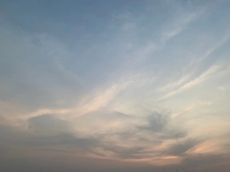
Cirrus
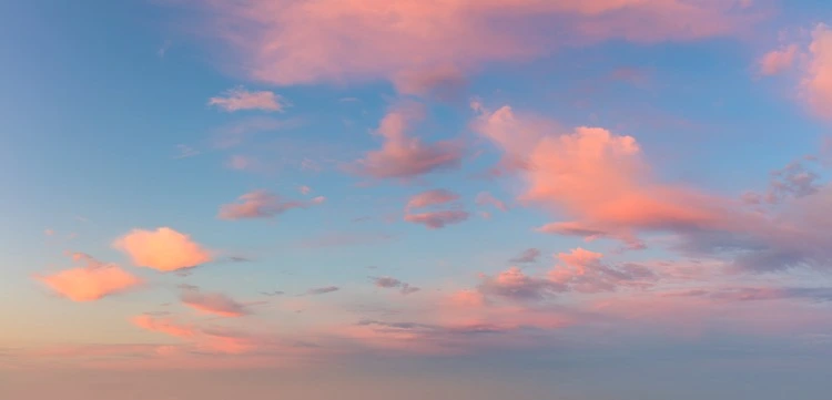
Cirrus clouds are often described as delicate, transparent filaments, existing in the sky with a hair-like appearance. The extent to their transparency depends on how separated the ice crystals are within them. They are also often the star of the show in sunsets, lighting up with remarkable shades of yellow or red across the sky as sunlight passes through them.
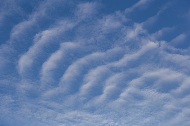
Cirrocumulus

Compared to cirrus clouds, cirrocumulus clouds have a much more rugged and grainy appearance – similar to that of honeycomb – and are often found with cirrus or cirrostratus clouds in the sky. They tend to be short-lived and can be formed through the vapour trails left by planes as they fly through the atmosphere.
Cirrostratus
Cirrostratus clouds are transparent clouds that can stretch for thousands of miles and take on a veil-like appearance. They can produce spots, arcs of light or white or coloured rings around the sun and moon, known as halo phenomena, as this light refracts off ice crystals inside the clouds.
Mid-level clouds
Three different sub-categories of clouds all exist within the mid-level cloud umbrella: altocumulus (Ac), altostratus (As) and nimbostratus (Ns).
As they are lower in altitude than the ones mentioned above – and consequently exist in less cold temperatures – mid-level clouds are made up mostly of water droplets. However, in spells of cooler weather, they can be composed of ice crystals.
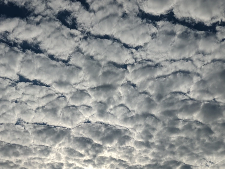
Altocumulus
Spotting these clouds in the sky may make you breathe a sigh of relief, as altocumulus clouds are often associated with settled weather. They are formed of layers or patches of clouds known as cloudlets, and composed of both ice crystals and water – lending to their fluffy appearance.
To spot the difference between cirrocumulus and altocumulus, one can look at the shading on the clouds: the former are often white and tiny, whereas altocumulus can be white or grey and have shaded sides.
Altostratus
These featureless clouds appear as grey or bluish sheets, either totally or partially covering the sky. In parts, they are thin enough to see the sun through, albeit weakly.
Rainfall is rare from altostratus clouds, but when this occurs, the cloud has become a nimbostratus.
Nimbostratus
Formed from the deepening or thickening of altostratus clouds, the sight of a nimbostratus cloud may instinctively make you check the weather forecast.
These dark, brooding clouds often bring the likely chance of snow or continuous rain and, as the Met Office describe them, are the ‘least picturesque’ of all the main cloud types.
Low-level clouds
Four types of clouds can be categorised as low-level clouds: cumulus (Cu), stratocumulus (Sc), stratus (St) and cumulonimbus (Cb), although cumulonimbus reaches high altitudes due to its tower-like shape.
These clouds are usually composed of water droplets.
Cumulus

Reminiscent of the clouds of childhood doodles, cumulus clouds are fluffy, detached and ‘cauliflower-shaped’, spotted during bright and sunny days. They are a common indicator of fair weather and appear during the morning before disappearing by evening time.
These clouds are formed via convection, a process in which air heated at the ground surface is lifted and then cooled. This forms water vapour that eventually condenses to create cumulus clouds.
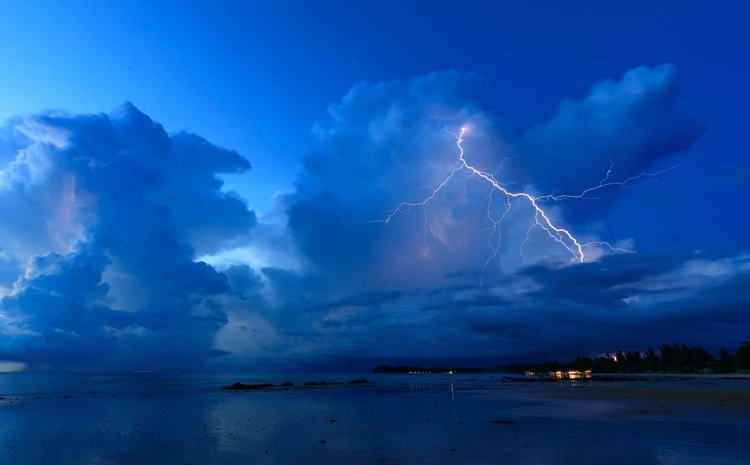
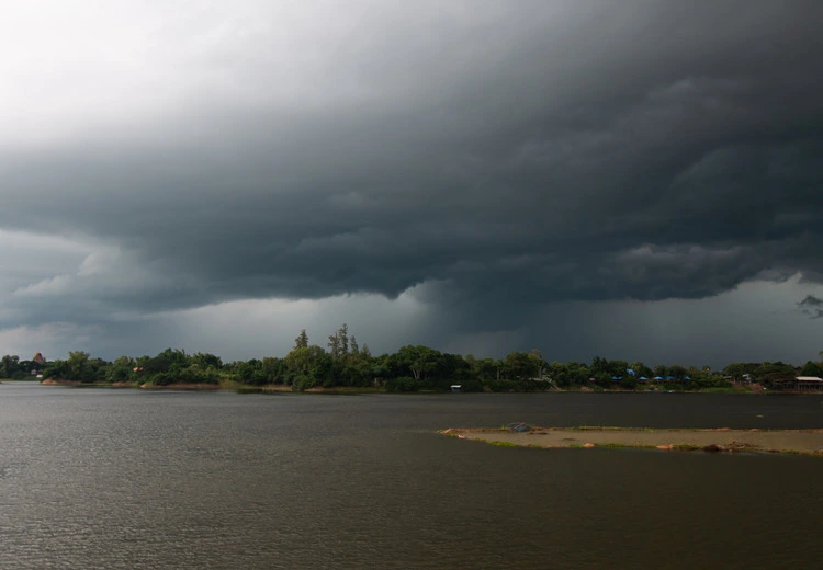
Cumulonimbus
Head inside if you see one of these, unless you fancy the heavens opening up on you: cumulonimbus clouds are heavy, dense clouds – known as thunderclouds – that can bring not only heavy rainfall but hail, lightning, tornadoes and other severe weather.
A fully-developed cumulonimbus may appear anvil-shaped, spreading out across the sky. As it spreads, a cumulonimbus may cause cirrus clouds to develop.
They are formed via convection, usually developing from cumulus clouds, and can end up storing vast amounts of energy inside them – equivalent to that of 10 Hiroshima-sized atom bombs.
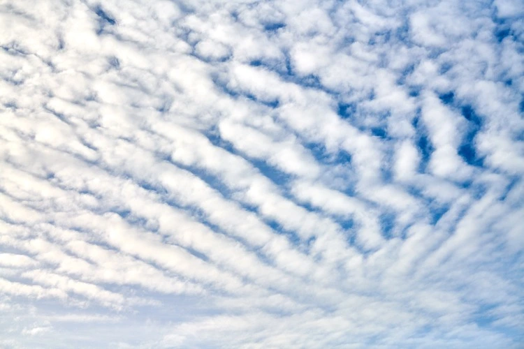
Stratocumulus
With a distinct patch-like appearance of grey and white clouds, stratocumulus clouds can appear like honeycomb and have distinct bases. These low-lying clouds can extend over vast distances and are the most common clouds on Earth.
Their presence often indicates a change in weather is coming, but stratocumulus clouds are commonly mistaken for bringing bad weather only. In reality, it is rare for them to produce more than a very light drizzle.
Stratus
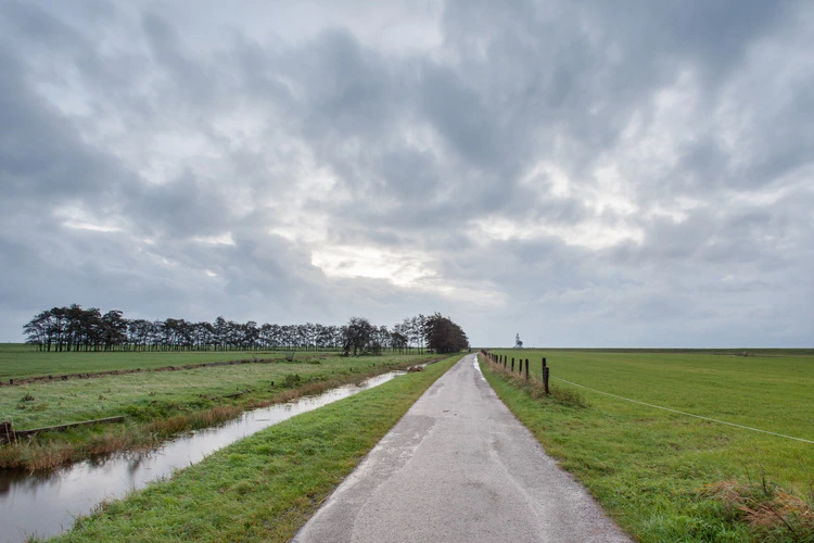
Stratus clouds can stick around for a long period of time, bad news for those who wish to see a blue, sunny day. The grey layer they form can easily blanket a sky and allow little light in – taking on the appearance of a fog that doesn’t reach the ground– creating a dull and overcast scene.
They are formed in calm, stable conditions following gentle breezes which allows cool air to rise over colder land and ocean surfaces.