For the first time, scientists can accurately measure heat & intensity of ancient fires, offering crucial insights for managing environment today
By
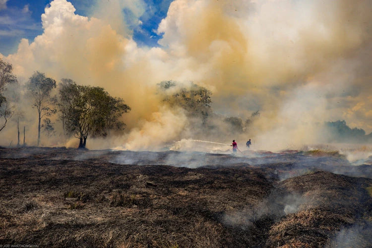
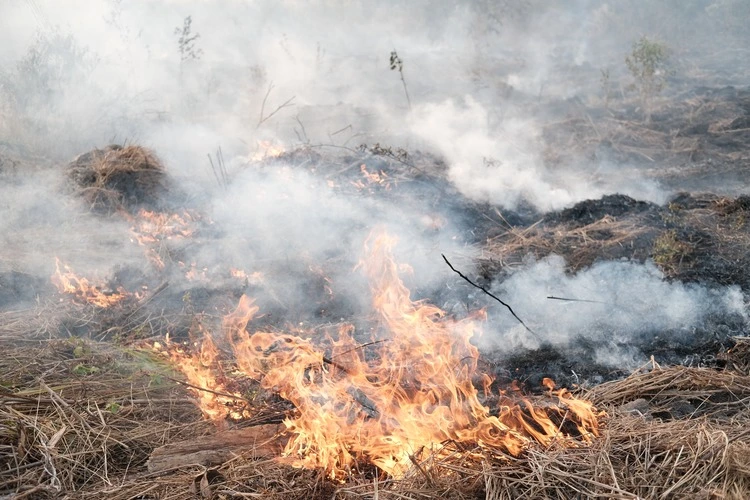
Peat fires are some of the largest and most persistent fires on Earth. In 2019, huge fires smouldered for months across Indonesia (home to the largest peatlands in the world), where they burned more than three million hectares of land – roughly the size of Belgium – and blanketed six neighbouring countries in a toxic haze.
The increase in wildfires is a major global concern, especially for vulnerable wetland ecosystems that play a key role in fighting climate change. Although they account for just three per cent of the world’s land area, peatlands store 30 per cent of all soil carbon – more than twice the carbon held in all of the world’s forests. To effectively combat peat fires, it’s essential that we understand how they burn. Scientists in Scotland have developed a new technique that could provide the answers we need.
Enjoying this article? Check out our related reads:
For many years, researchers have attempted to determine the intensity of ancient wildfires by analysing the fossilised coal left behind. The existing technique, called ‘geothermometry’, involves studying the chemical changes that occur after the coal has been heated in a furnace. The idea is that these changes reflect the original fire’s heat, ‘but that’s just not how wildfires work,’ says Thomas Theurer, a geoscientist at the University of Aberdeen.
During a wildfire, Theurer explains, the fire front emits radiant heat that preheats nearby fuels. As the front advances, it ignites these fuels, causing surface combustion and the release of heat and gases. Following the main fire, smouldering may occur, particularly in denser fuels, as remaining material slowly oxidises. ‘A lot of these stages simply aren’t picked up by furnace experiments,’ he adds.
The new method used by Theurer and colleagues at the universities of Aberdeen and Edinburgh, however, allows researchers to study these different heat fluxes. ‘You’re essentially generating a mini wildfire in a dish,’ he says. And, while the research focused on samples taken from peatlands in the Falkland Islands, the scientists found that the type of fuel didn’t matter for their energy calculations.
‘Theoretically, you could apply this technique to understand the behaviour of any wildfire,’ says Theurer, ‘from the present day all the way back to the first evidence of wildfire 420 million years ago.’
Wildfires are part of a natural cycle in forests. How often they happen, how big they get and how hot they burn depends on a range of factors from the tree species to the weather, and even long-term climate changes over hundreds or thousands of years.
But humans have been modifying this natural cycle for thousands of years, ‘particularly through fire suppression,’ says Theurer. ‘That, and the loss of Indigenous fire-maintenance practices, particularly in Australia and the western USA, are key drivers of these really intense fires that we see nowadays. That’s why understanding ancient fires is crucial – it allows us to establish a baseline, a “before” picture, of natural fire patterns before human influence.’
The next phase of his research involves comparing these experiments with real-world wildfire data from satellites, but Theurer also sees potential beyond wildfire studies. He points out that charcoal isn’t exclusive to wildfires, appearing in archaeological digs, cremations and even agricultural soils. ‘There’s potential for applications in a range of areas, from forensics to agriculture.’